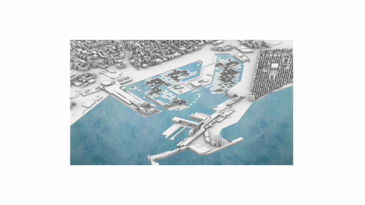
Waterfronts are seen as multifunctional locations for economical and environmental activities, this growing uncertainity needs a long term resiliency, Floating technology is not something new in addressing resiliency in the waterfront .
By moving to the waterfront helps balance the needs of the city by bringing in these floating structures based on the demands for the city to perform better . being floating, gives an advantage of not being static , floaters can move and reconfigure within the existential limits to address any temporal needs. In this experiment we tried to elaborate on this topic, how temporal reconfigurations of different elements address the city performance based on scenarios. The study specifically focuses on semi, fixed and movable elements and how that could help daily or short term needs.
Site selection
The area that was used for this simulation is Barceloneta, dockyard in front of passeig de colom. This particular location has a multifunctional characteristic throughout the year being to address the local people’s need for functional spaces or the tourist demands and also the seasonal changes.
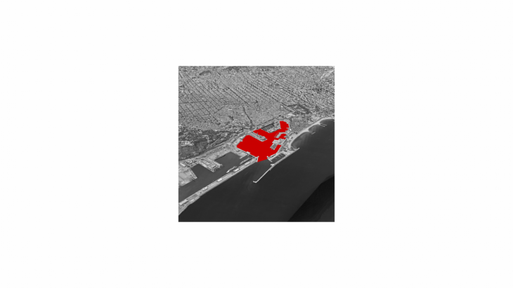
Fig.1 – Selected site
Data collection
The project focuses on the redistribution of the existing density of inhabitants into the waterfront for better living conditions. So, the study location boundary is demarcated within 20 min walkable radius from the waterfront. In this way, the project could control the redistribution within a specific zone identifying the highest inhabitants blocks and redistribute them on the water
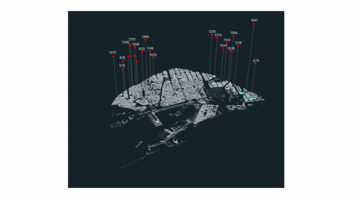
Fig.2 – selected location with the highest inhabitants numbers
Inputs and Design Space
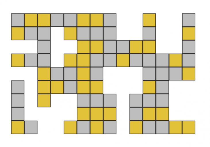
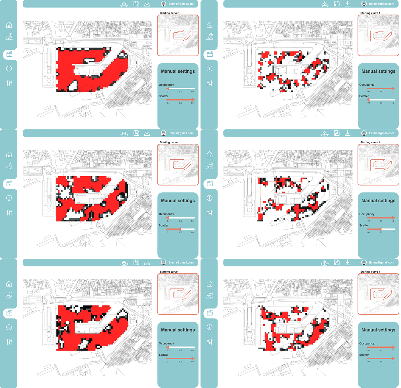
The study utilizes the cellular automata tool to generate urban distribution planning. So the initial preparation is to set up the cellular automata to carry out this process. Cellular automata generate a set of combinations within the 9 neighborhood cells with 1’s and 0’s to indicate live and dead cells. From this set of configurations, through controlling the domain we cluster the preferred configuration within this huge set based on the number of live neighboring grids required. By setting up the initial curve, it controls the location to place the distribution criteria. Through this, the initial setup of the archipelago is generated. This tool is further controlled by crowdedness to have the possibility to vary the occupancy density of the floaters on the waterfront.

Fig.3 – cellular automata Von Neumann/ Moore neighbor
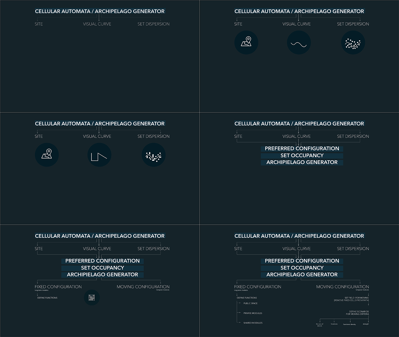
Further from this setup, the division between the fixed and moving floaters are performed based on the crowdedness distribution. The reduced number of selected cells to avoid the space being overcrowded (for example we consider only numbers greater than 3).

Based on this, the tool segregates the cells which can move and the ones which cannot – defining our fixed and movable floaters for the location.
With this initial stage, the project defines a set of matrices, based on the selection criteria and the crowdedness to guide the planner to further simulate the preferred option.
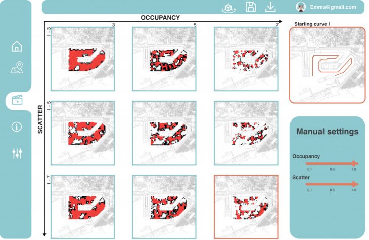
Procedural Geometry/ Data Generation
Once the preferred distribution of fixed and movable floaters is selected. The study steps to the functional distribution for the fixed elements. Here we start allotting the cells with a unique functionality based on the site context. The pier is dedicated to a private function, the edge is for public functions and the rest is for amenities. The simulator picks the cells based on the proximity to the site conditions. This is controlled by the percentage distribution of each typology. After fixing the functional distribution we have a catalog of modules for each category and the choice of picking based on the required numbers of each type.
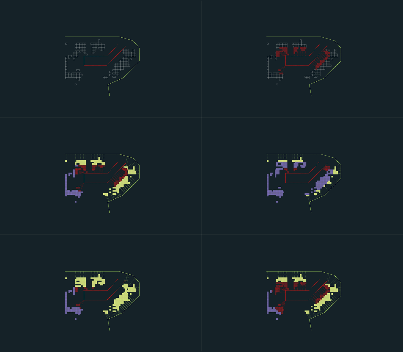
Demonstration
After defining the functional distribution on the fixed platforms, now the simulator can generate scenarios based on the existing context. Here, the moving floaters reconfigure based on the set conditions. These conditions for example the user can move the modules towards the area with higher residential density, higher leisure, or even interconnect all the islands or have the modules be placed around certain functions.
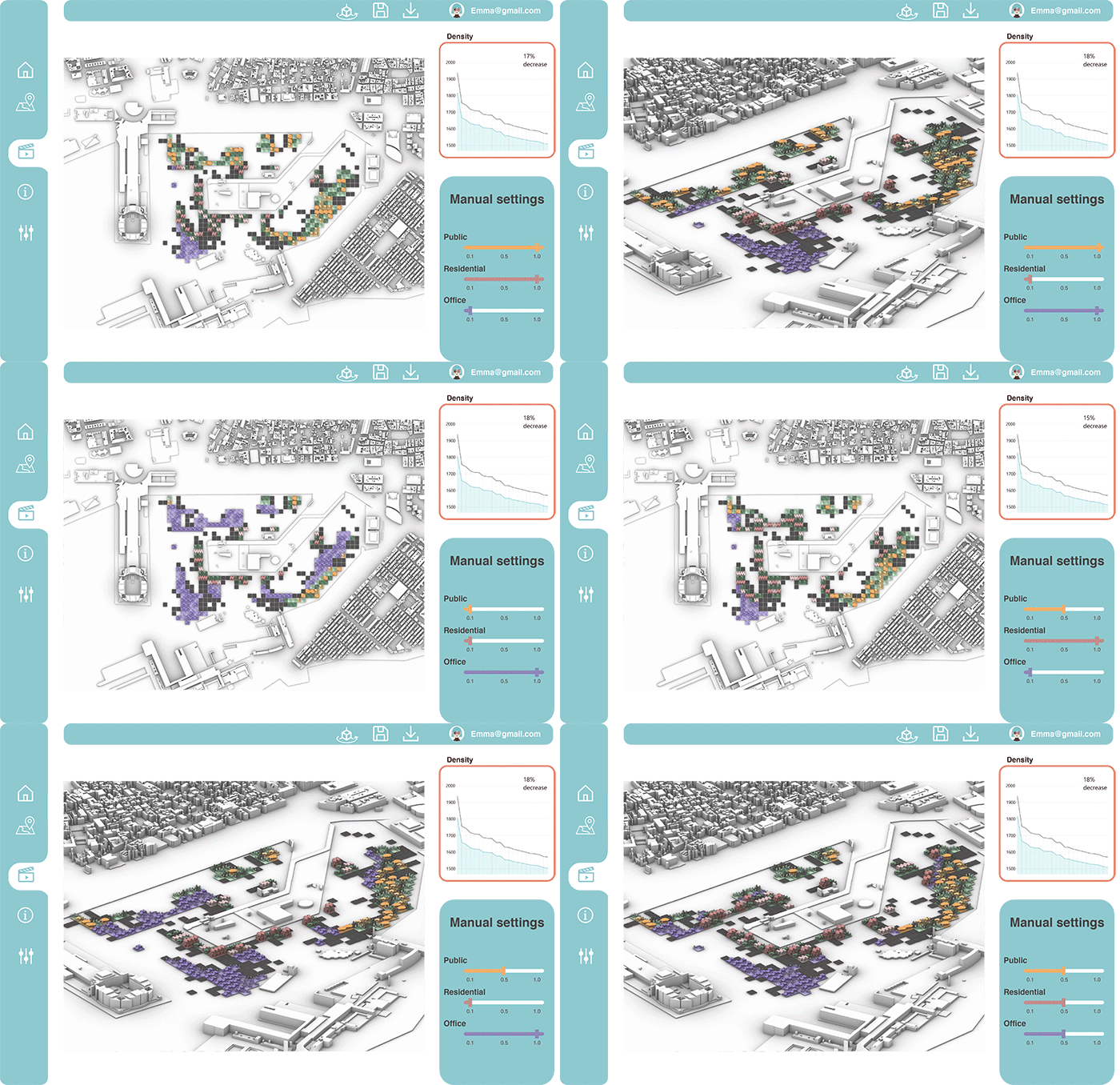
Based on the site conditions, we as a planer , are distributing the functions for the fixed elements. Here we start allotting the cells with a unique functionality based on the site context. The edge is for the public functions, the pier is dedicated for the private function, and the rest is for amenities ( for example offices).
The simulator picks the cells based on the proximity to the site conditions. This is controlled by the percentage distribution of each typology.

After fixing the functional distribution we have created a catalogue of modules for each category. Choice of picking is based on the required numbers of each type. The user can choose between 3 , previous mentioned categories ( public, residential, office). For each category we have a slider with different values. The user can have the option of viewing their chosen configurations in 2d and 3d. They can also see the impact of their chosen configuration on the existing site density .
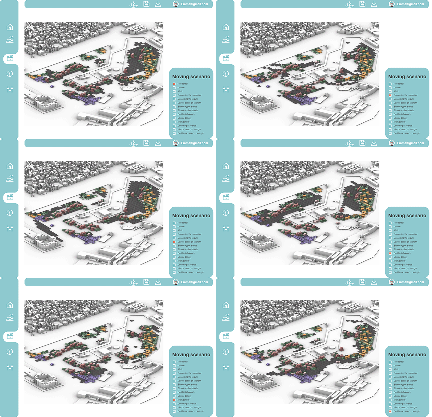
The user can then also have an overview of their selected scenarios in order to narrow down their choices. After that the user go to their preferred choice. The scenarios are developed based on the existing configuration of the fixed cells and with that for example, the user can move the modules towards the areas with higher residential density , higher leisure densities or even interconnect all the islands or have the modules be placed around certain functions.
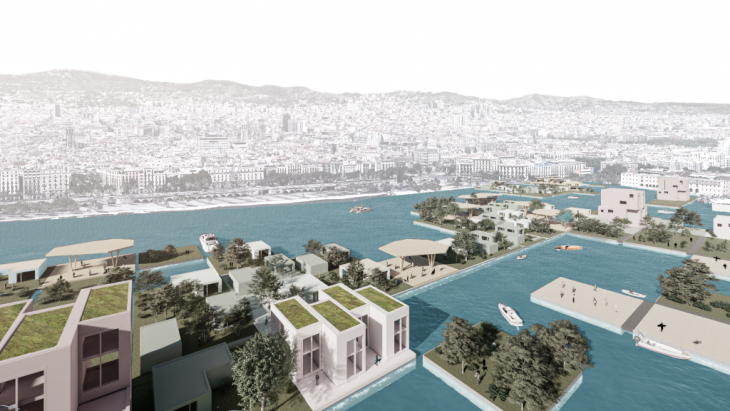
A bird’s-eye view new barcelona waterfront
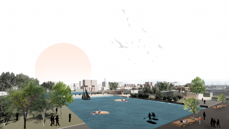
Human view new barcelona waterfront
Conclusion
In the end, this urban planning simulator can help the city to perform better on the key performance indicators by reclaiming some amount of usable area through the floaters. Then the temporal reconfiguration of these new functional spaces helps better improve the adaptability for the different scenarios based on addressing both short and long term. The cities are becoming intelligent so the infrastructure has to become flexible enough to address the demands.
Resilient Waterfront is a project of IAAC, Institute for Advanced Architecture of Catalonia developed at Master in City & Technology in 2020/21 By Student: Arina Novikova, Aishath Nadh Ha Naseer, Marta Galdys, Sridhar Subramani Faculty: Eugenio Bettucchi & Iacopo Neri & Alex Mademochoritis.