Abstract
Reversing the degradation or destruction of habitats is linked to some of the most important objectives in the fight against climate change, in general, and in the prevention of collapsing food chains. Addressing these issues within urban space is a contested, complex, yet important area of study. This work explores the creation of a set of tools that allow decision makers and designers to integrate ecological indexes as design variables. Specifically, this work uses the Urban Biodiversity Index as a tool for measuring impact. Through generative design procedures, the tools in this work allow its user to plan and design ecological corridors within the urban fabric.
Introduction
Cities are a complex set of systems within systems. Some of these systems work within the urban fabric (as would be the green infrastructure or the public amenities) while others are heavily reliant on external unions to other systems (such as food systems or mobility systems). These systems help serve the needs and wants of those who’s lives depend on said systems. In the process of producing cities, and in the process exponentially growing its urban metabolism, humans have severely altered the ecosystems in which cities have settled.
The process of urbanization requires the transformation of a particular landscape into an extension of the urban fabric. This process is overwhelmingly negative for the species that originally populated the urbanized space. Habitat destruction, or severe degradation, is the main exchange token for the process of urbanization. Habitat loss, or degradation, has been shown to cause severe effects on both local and broader environmental systems. In recent years, researchers and designers have challenged the accepted ecology of urban space buy proposing interventions that will create space, within the existing urban fabric, in order to bring back endemic species. The aim of this work is to increase the level of urban biodiversity within our area of study. In order to do so, we have developed a set of indicators that help us evaluate the results of our work.
Site
The simulator can be used anywhere but for the purpose of the course the city of Barcelona was used as a reference. For the selection we used the NDVI tool to determine the density of green and the plants health problems.
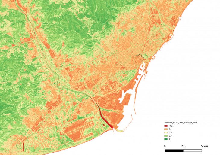
NDVI – Barcelona
We have selected one of the densest neighborhoods of the city of Barcelona, El Born, as our area of study. Part of the Ciutat Vella district, El Born’s urban history dates to the Roman period of occupation in the Third Century of the Current Age. None the less, the urban fabric we know today was established between the 13th and 15th centuries4. We’ve chosen El Born for two main reasons: The tightly packed urban fabric has severely limited the amount of public space (and public greenery) in the neighborhood. Secondly, the El Born is situated at the limits of the Ciutat Vella and borders el Parc de la Ciutadella, one of the biggest public parks in the City. In choosing El Born, we aimed at creating green habitats that would connect the inner parts of El Born with el Parc de la Ciutadella.
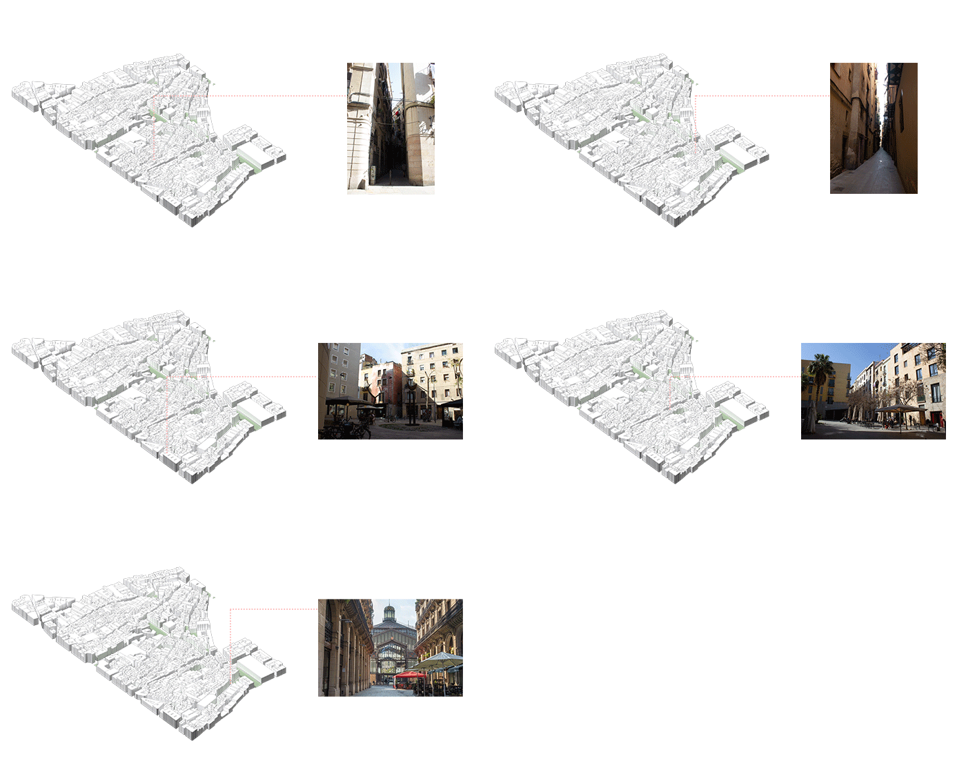
El Born context
Concept
This work aims at increasing urban biodiversity in the city of Barcelona through the creation of green corridors that connect el Parc de la Ciutadella with the inner parts of El Born, using the actual public space for the creation of new hubs for the animal habitat. We were faced with two main challenges: deciding on the paths that should be converted into corridors ands the re-grid of the urban fabric in El Born, in order to increase biodiversity.
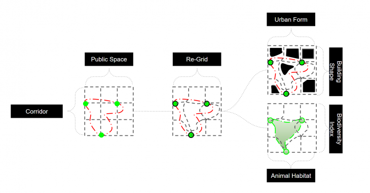
Concept
Our work is based on Urban Biodiversity Atlas that was generated by the Barcelona’s Ayuntamiento. The Atlas contains an index of species that have been observed to inhabit the City of Barcelona. The findings within the Atlas are organized by types of species and by their associated location within the city. Based on this data, we where able to generate our first Indicator: The Urban Biodiversity Index. The Urban Biodiversity Index shows the rate of species diversity within a given area. From this data we also generated a short-list of species that was then used as case studies to design our green spaces.

Attribute/ Habitat Based Biodiversity Index
Methodology
Our procedure is a three-part process that simulates the reshaping of the urban fabric into new habitats. The output of the simulation is the process of codependent sub-procedures. The data that is used from the first procedure is then used as the basis of the second which in turn becomes the basis for the third and final procedure. While our work uses information from various analytical environments, such as Geographical Information Systems, all of the simulations where developed and executed in the Grasshopper visual programming environment.
In order to assess the routes of the ecological corridors as well as their layout, we have decided on two three types of simulations: Pathfinding, Subtractions and an Occupation simulation for the plants.
The Pathfinding Simulation was generated through the Wooly Paths Definition, which was developed using components of the Kangaroo Plugin. The Definition allows us to generate an organic path based on two forces that can be lines (connections) which can be controlled based on parameters such as spring stiffness, rest length and stick behavior. These parameters interact within a loop which allows to observe the infinite possibilities to create the new organic path between the points or objects to be connected.
The Subtraction Simulation was created through the solid difference component. This component helps generate subtractions in the urban fabric and along the paths generated by the previous simulation. The subtractions in the urban fabric generate different intervention typologies. These are based on the varying sloping degrees of these cuts. It is in these interventions that we then transform into green spaces, this subtractions can be these subtractions can be controlled according to how much area is to be affected, so that the subtraction of buildings can be minimal or very radical depending on the user and the desired biodiversity of the area.
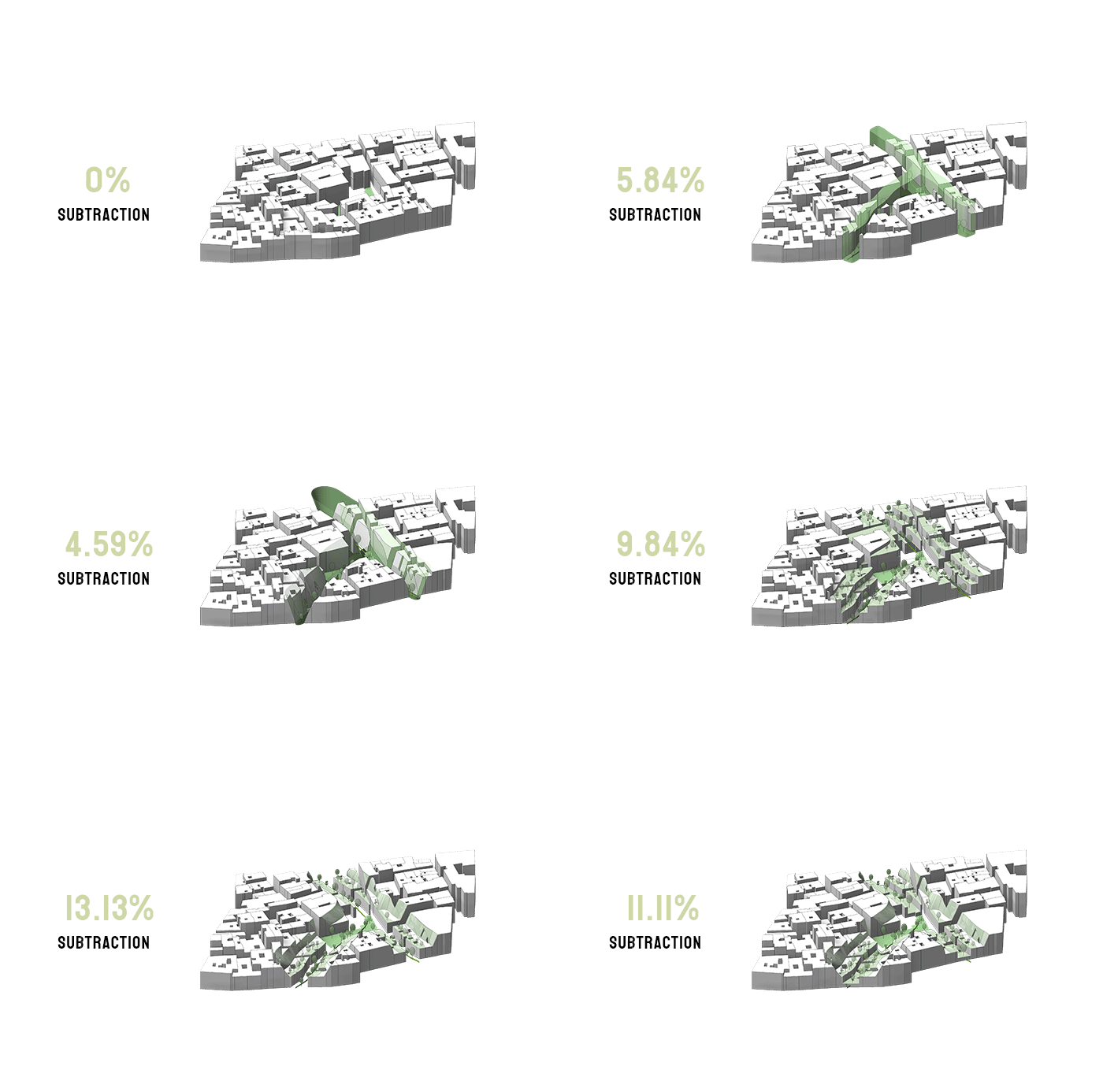
Type of Subtractions
The Occupation Simulation is based on the Circle Packing definition found within the Kangaroo plugin. This simulation’s goal was to help visualize the optimal planting schedule within the selected sites of intervention. In order to do so, the simulation uses as input raster data from the output of the Subtraction Simulation to assign places and locations for the plants. The simulation also uses the predefined radius of the plats we included in the simulation in order to generate the schedule. The simulation reads the output of the Subtraction Simulation as a height map and, using the radius of the selected species, allocates plants to their assigned value.
Simulation
In order to transform our procedures into a tool for planners and decisionmakers, we have integrated these simulations into a single environment through which users may interact with the different variables and generate new scenarios. The User Interface (UI) allows users to select the area of intervention through a map. In a second step, the UI allows the user to select the control points for the path generation simulator. Once the paths are selected, the UI can provide feedback of the areas that will be affected by the new path.
In the second phase of the process, the user is then allowed to control the steepness of the slopes that will cut through the urban fabric. The final part of the process allows users to control the type of plant species that would from the basis of the Occupation simulation. This final process generates the Urban Biodiversity Index (UBI) which is shown as part of the UI. The Interface also allows the user to contrast the original UBI of the site with the simulated UBI, which helps users understand the magnitude, efficacy and efficiency of their interventions.
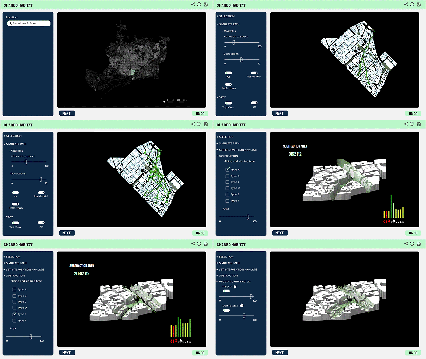
User Interface – Shared Habitat
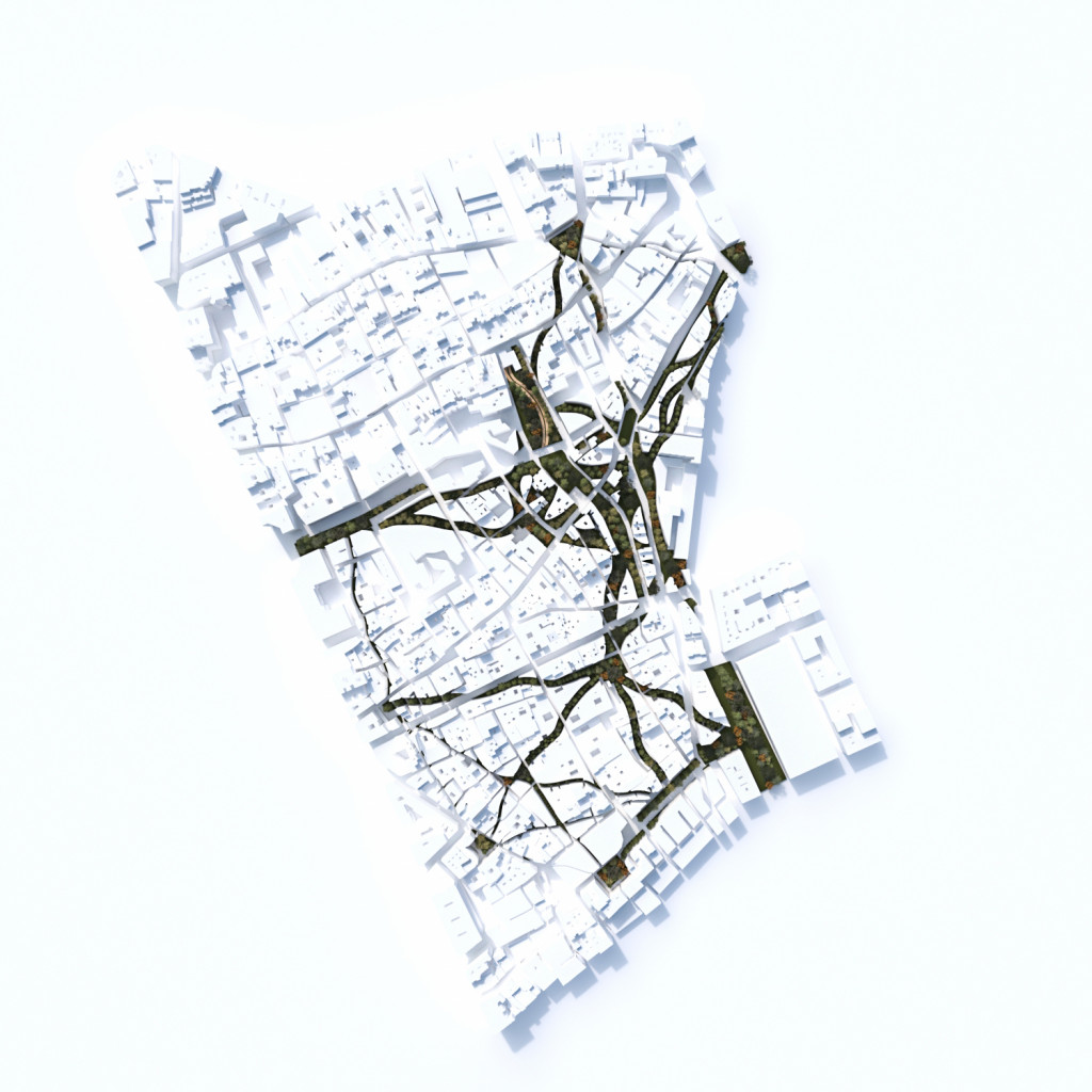
Urban Plan Simulator
Conclusion
Reversing the degradation or destruction of habitats is linked to some of the most important objectives in the fight against climate change, in general, and in the prevention of collapsing food chains. Addressing these issues within urban space is a contested, complex, yet important area of study. While urban space has been predominantly designed for human activity, there are a myriad of negative externalities that severely affect our health and livelihoods89. Integrating habitats for non-human lifeforms within urban space is both a symbolic representation of the symbiotic relationship between human and non-human systems as well as a partial solution to larger environmental problems caused by the expansion of human settlements. The tool presented in this work aim to provide designers and planners the ability to input environmental variables into the equations of spatial and formal configuration. Through this methodology we are overtly stating that ecological indexes need to form the basis of design and decision making within the urban sphere if we are to address the sustainability of our systems.
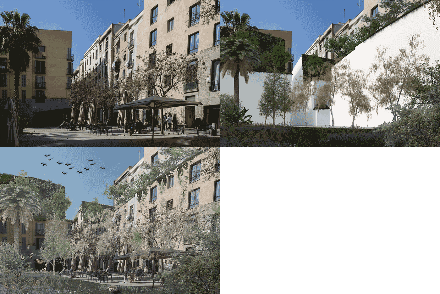
Future Vision
Shared Habitat is a project of IAAC, Institute for Advanced Architecture of Catalonia developed at Master in City & Technology in 2020/21 by students: Kevin Aragón, Miguel Tinoco, Mario Gonzales and Iván Reyes and faculty: Alex Mademochoritis, Eugenio Bettuchi & Iacopo Neri