What is urban air quality?
Today almost every big city in a world faces urban air quality issue. Poor air quality affects our health and adversely impact economy. The most vulnerable social groups are children and seniors. The most harmful component is nitrogen dioxide. Its high concentration causes thousands premature deaths in European Union every year. 50% of children asthma cases are attributable to oversized concentration of NO2.
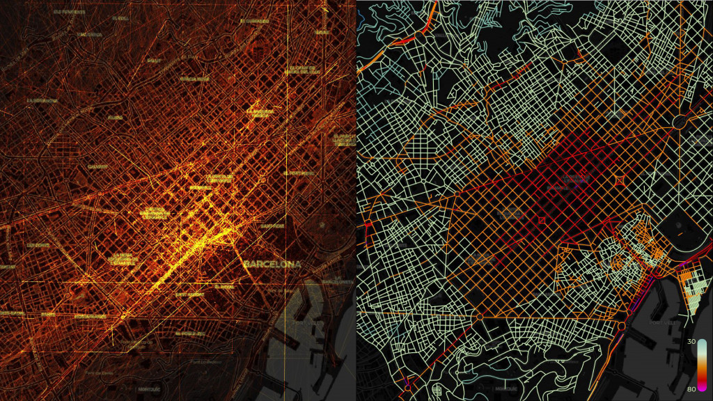
As we all know, vehicles are the main contributors on urban emissions and especially they are the main source of nitrogen dioxide.
Today we are able to monitor air quality in our cities by sensors, satellite images etc. That measure helps us to avoid contaminated areas and aims to tackle the issue. The goal of that project is to investigate what tools we can apply to predict and check air quality in a real-time.
How we check air quality today. Possibilities.
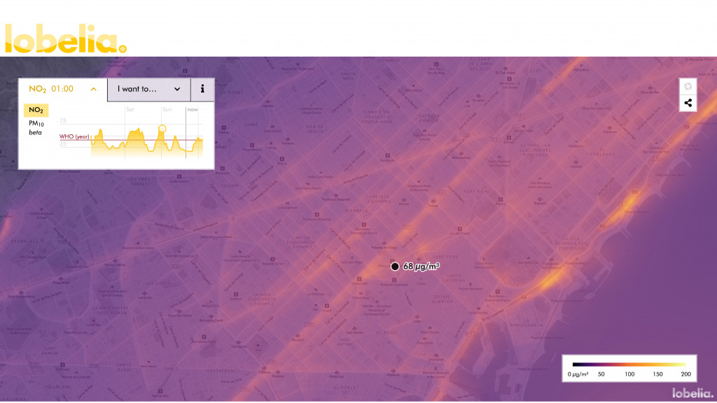
There are numerous of ways and tools to observe air quality. Smartphone applications, webpages, citizen science tools. Let’s take a look at one of them. Lobelia earth is one of the states of art project in that sphere. The platform that calculates nitrogen dioxide concentration now operates in 3 cities in Europe. Their algorithms are based on satellite images, traffic jams, weather forecast and updates every one hour.
That method is accurate enough and shows us detailed picture of our city. However, it takes a lot of computation power and time. The question that I want to arise here is: what can be another less labor-intensive method to do so?
As we already said, the main culprit of high NO2 concentration is a vehicle. Therefore, what if we can reveal that concentration based on the number of vehicles on the street? The tool that can help as proceed is machine learning.
Data and methods.
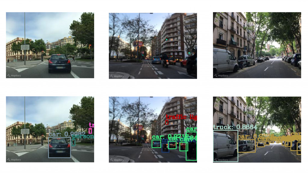
The idea is quite simple. By using street images from different street of Barcelona and counting number of vehicles on them we can classify streets according to their average nitrogen dioxide concentration. The initial data comes from Mapillary and lobelia.earth. Using images from Mapillary and associating them with air quality map allows us to generate data for the future manipulations. The first method is object detection with YOLO machine learning algorithm. We calculated number of vehicles for 2000 images and separated them for 3 different categories: low pollution, moderate and high.
Therefore, by checking new image we will see what category it belongs to. Another way of achieving similar result is supervised classification. Although, it is based on the previous one it allows us to find pattern on images and can reveal unexpected results. Nevertheless, it still shows us result in numbers as it also categorizes images.
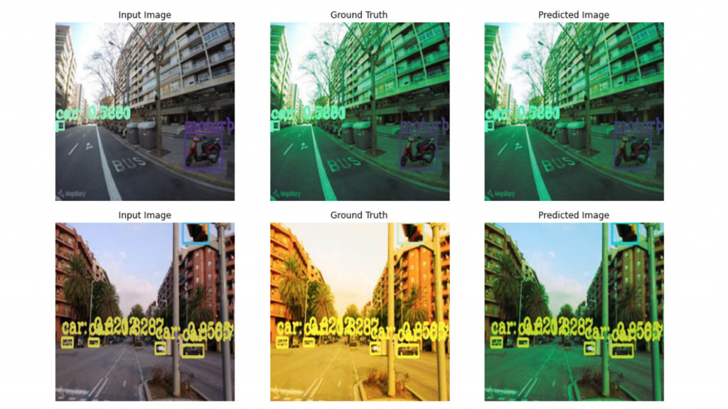
In order to attain more visually understandable outcome, we can introduce pix2pix algorithm. It learns on input and output images in order to generate prediction so, requires a little bit different dataset. We took the data we created for the previous methods and created pair for each image. Now, we can train pix2pix model.
Pros and cons. Next steps.
Despite the fact that the prediction in our case is not very accurate we still see some positive outcomes. First of all, that method takes less computational power and generates real-time result. Moreover, the greater dataset for sure can increase accuracy. Of course? there is something to strive for. The next step could be using short 30 second video instead of stable image. It will allow us to calculate only moving cars and not those that are parked. That will increase accuracy. On the other hand, electric vehicles don’t directly contribute to poor air quality, so they have to be not taken into account. That brings another challenge, to learn machine identify different types of vehicles.
Summarizing, the method of revealing air quality based on street images can be applied for different purposes, one of them augmented reality. Needless to say, there are many things that we have to improve in that method, but it opens conversation about what are those other tools that can help us tackle urban air quality issue.
Data sources:
https://www.mapillary.com/
https://lobelia.earth/
Revealing air quality based on street images is a project of IAAC, Institute for Advanced Architecture of Catalonia
developed at Master in City and Technology,
AI in Urbanism II in 2021 by:
Students: Linara Salikhova
Faculty: Angelos Chronis, Serjoscha Duering, Nariddh Khean


