Deiliskipulag App Deiliskipulag App– Digital Tools for Cloud Based Data Managment
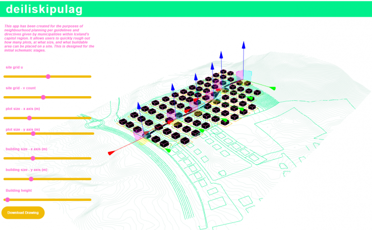
What does the app do ?
a deiliskipulag is a detailed city planning drawing in Iceland’s capitol region (around Reykjavik)
Municipalities provide a specific plot and ask architects to design plot size, street layouts, building sizes and heights.
This app allows users to quickly rough out how many plots, at what size, and what buildable area can be placed on a site through the use of sliding parameters, as well as determine where the main street will run by pushing and pulling crv controle points.
Once happy with the configuration the users can then export the drawings for further refinement
This is designed for the initial schematic stages.
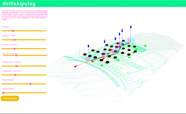
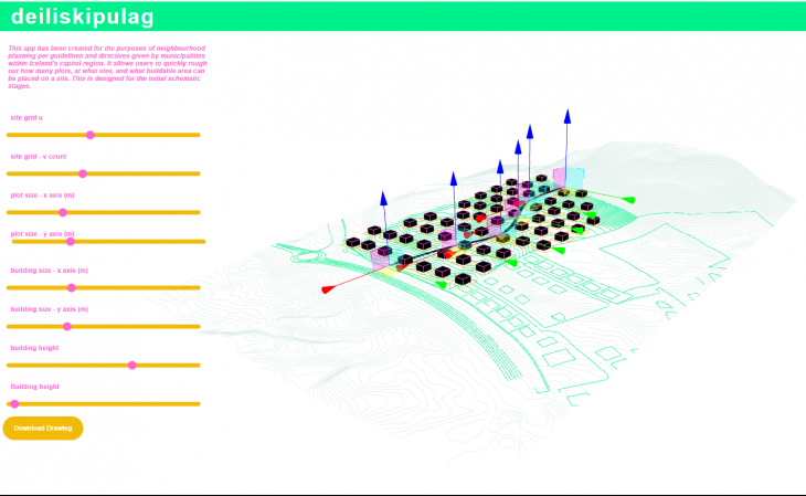
changing grid size
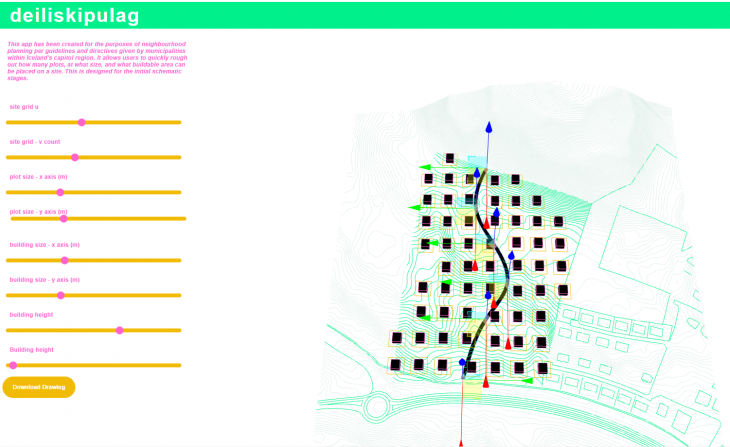
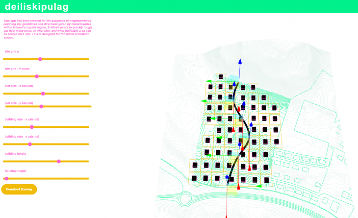
changing plot size
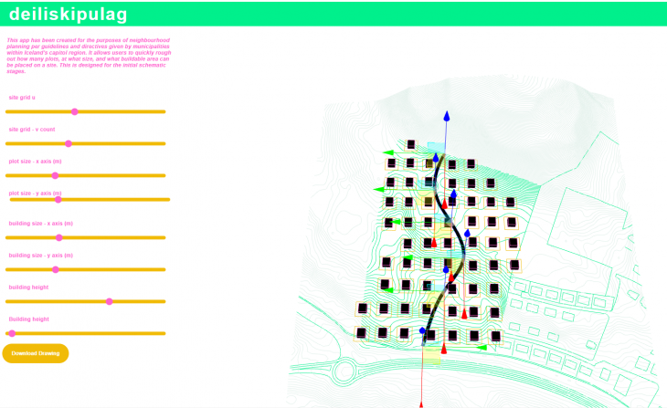
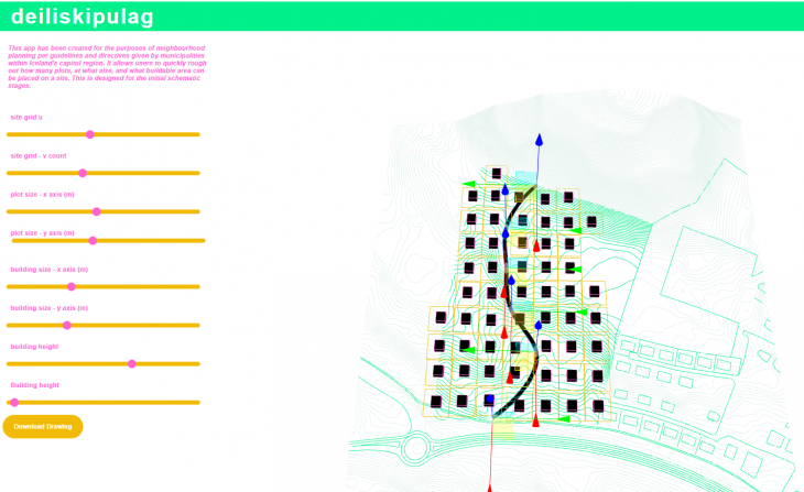
manipulating street form
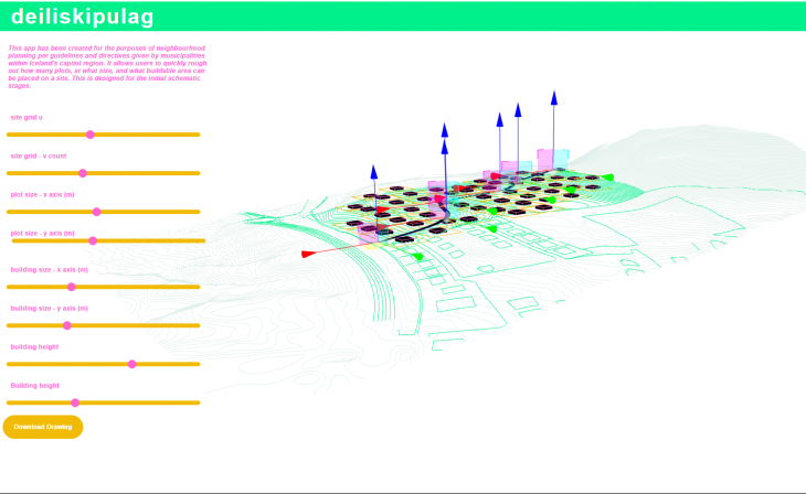
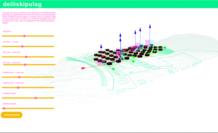
changing building dimensions
Who is it intended for ?
my co-workers!
our office often works on deiliskipulag projects, and having recently worked on one myself, I found the schematic stage to be filled with unnecessary busy work. Using GH I was able to iterate and work through this step a lot faster than just manually iterating by hand or in CAD software.
With the exception of one other person, no one in my office uses grasshopper, so I wanted to create user friendly app that would make GH more accessible, and reduce unnecessary time spent on the initial stages of these kinds of projects.
Data Flow
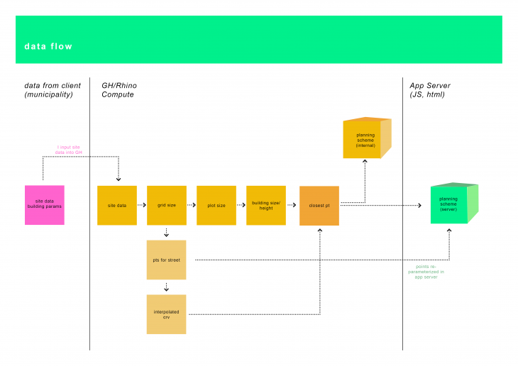
The apps data flow is quite simples. The site parameters are sent my the client and then input (by me)into the app background.
Once a grid has been established users can then begin pulling plot size, and building dimensions. Same goes for the points which build the street, where data from the indivdual plots interacts with the street data in the closest point widget. It is here that we see the real-time reaction between the two points – thus giving us a better understanding how the main street, community grid and site topography coalesce.
This data is uploaded to the app server in a very similar way, accept for the points which need to be re-parameterized in the JS source code.
 Code Concept
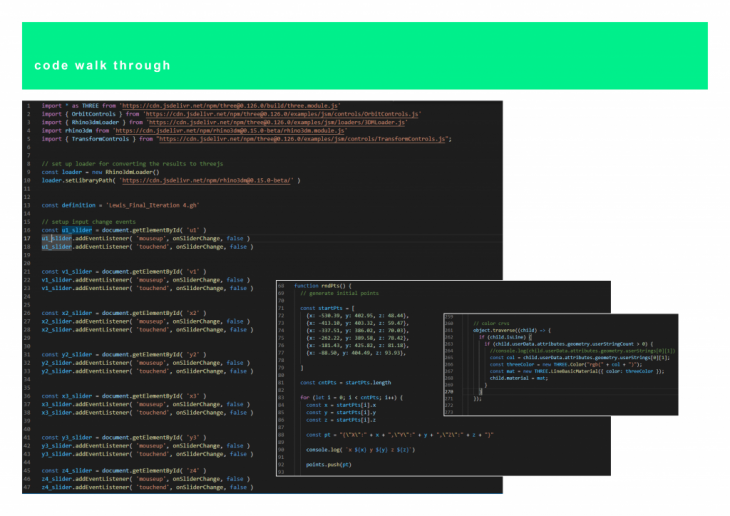
The template I used to build the deiliskipulag app from the node example provided in class. Where I made the following changes
- added more sliders
- curve + mesh rendering setting
- light + camera settings
- had to change the how the points are read + transform controls
Challenge 1: working through the code and determining which inputs and functions are no longer necessary or even problematic to the direction you want to take your project
Challenge 2: having to understand the relationship between data overrides between rhino compute and the app server
 To be improved
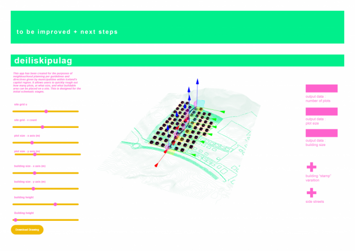
- Have real time data feedback in the app would have been really helpful – it would be nice to see projects metrics as the user was manipulating the project parameters
- Placing side streets, and manipulating them in a similar way as the main street, would have allowed for more detail and resolution
The was a fantastic seminar, and I certainly plan on further developing this app !
Please use the following link to access the app:
https://bimsc22-deiliskipulag.herokuapp.com/examples/deiliskipulag/
Deiliskipulag App is a project of IAAC, Institute for Advanced Architecture of Catalonia developed in the Master of Advanced Computation in Architecture and Design 2021/22 by
Students: Zoé Lewis
Faculty: David Andres Leon and Hesham Shawqy