30-MIN by walk
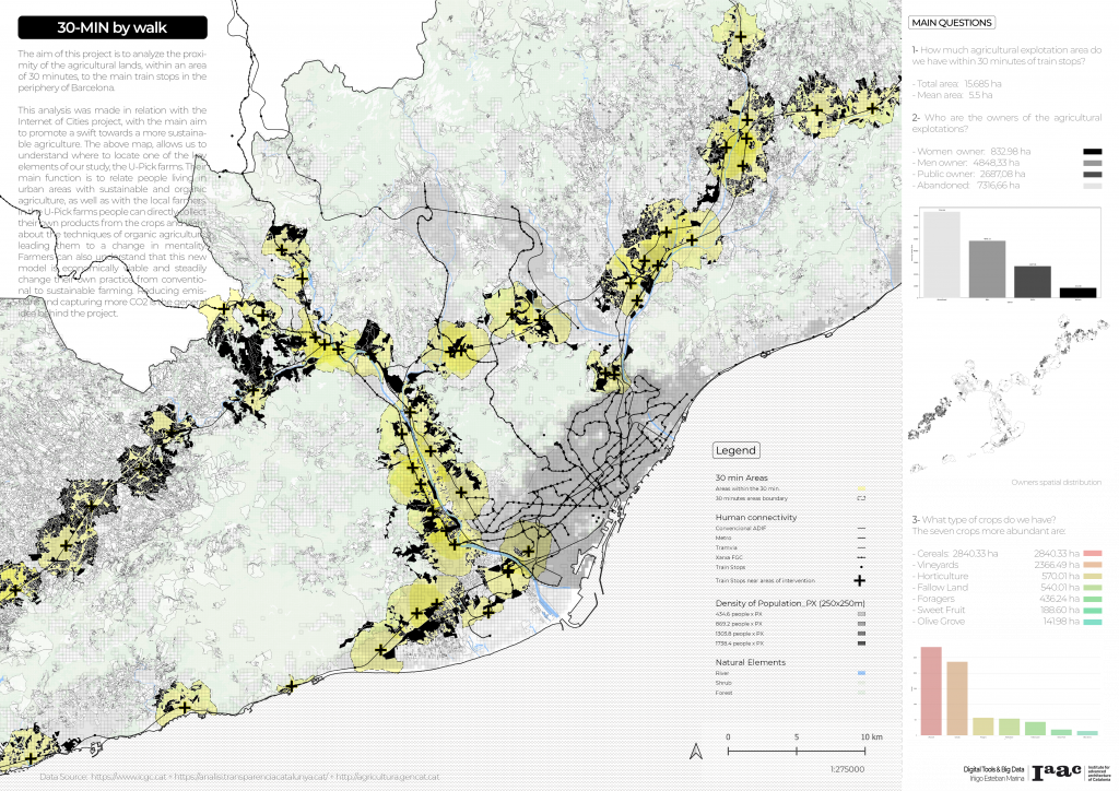
The aim of this project is to analyze the proximity of the agricultural lands, within an area of 30 minutes by walk, to the main train stops in the periphery of Barcelona.
This analysis was made in relation with the Internet of Cities project, with the main aim to promote a swift towards a more sustainable agriculture. The above map, allows us to understand where to locate one of the key elements of our study, the U-Pick farms. Their main function is to relate people living in urban areas with sustainable and organic agriculture, as well as with the local farmers. In the U-Pick farms people can directly collect their own products from the crops and learn about the techniques of organic agriculture, leading them to a change in mentality. Farmers can also understand that this new model is economically viable and steadily change their own practice from conventional to sustainable farming. Reducing emissions and capturing more CO2 is the general idea behind the project.

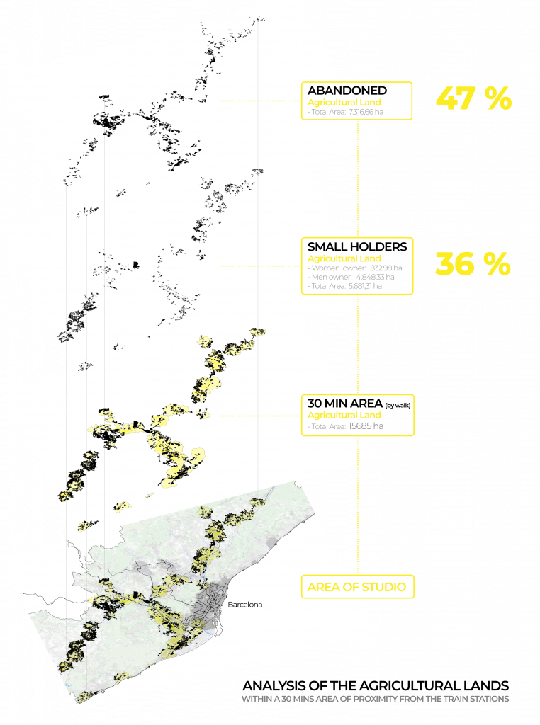
In black the rail transport infrastructure and their network in the territory, are depicted. Using the stops as a central point, we can identify in yellow the areas that are within less than 30 minutes walk from the stops (which facilitates their communication with the train).
All the farms that appear in black are in contact or contained in these areas of influence. To carry out these operations, the Qgis ‘OSR Tools’ plugin has been used, and subsequently different geometric and spatial operations have been carried out to obtain all the agricultural areas in black.
Once this has been achieved, these areas have been further analyzed in order to calculate their area, the owners and the type of crop produced, as well as their spatial distribution. This analysis has been carried out through python using libraries such as pandas, numpy and seaborn.

CONCLUSIONS:
Thanks to this analysis we can understand the stakeholders we need to deal with and the proportion of agricultural land which meet the conditions we need to locate our strategy element. With this information, we can do a further analysis over the lands that we have classified as the best to work as a U-Pick farm based in more detail conditions.
SOURCES
The sources of the data are:
[ www.icgc.cat + www.amb.cat + analisi.transparenciacatalunya.cat + agricultura.gencat.cat ]
30-MIN by walk is a project of IAAC, Institute for Advanced Architecture of Catalonia developed at Master in City & Technology in 2020/21 by student: Iñigo Esteban Marina, and faculty: Diego Pajarito