CITY DATA VIEW
TREES FOR LIFE. Master Plan for Barcelona’s Trees 2017 – 2037
The City of Barcelona is facing major challenges in the 21st century in terms of improving its population’s health and comfort. These require the development of a sustainable, equitable and inclusive city, with improvements to fundamental features like environmental quality, especially in relation to the pollution generated by fossil-fuel vehicles, the urban land balance and public services for all of the municipality’s neighbourhoods, decent housing, the fight against climate change and responding to migratory movements.
Trees in the urban environment are living organisms that live with people and provide them with a physical and emotional connection to nature.
Let’s use data as a driving force in decision making
THIS MAP SHOWS the height of the species and geolocation of the trees of the city of Barcelona located on public roads.

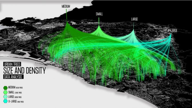
SIZE AND DENSITY _ Urban Trees Barcelona
THIS MAP SHOWS the number of urban trees in Barcelona. It is made a relationships between quantity and the zones of the city where inhabitants have more benefits of trees.

TREES SCANNER _ Urban Trees Barcelona
DATA SOURCE: Zone trees of the city of Barcelona. (OPEN DATA BCN). Map of Barcelona. (CARTO BCN)
CITY DATA VIEW_TREES FOR LIFE is a project of IaaC, Institute for Advanced Architecture of Catalonia
developed at Master in City & Technology in (2019/2020) by:
Student: Byron Cadena
Faculties: Rodrigo Aguirre