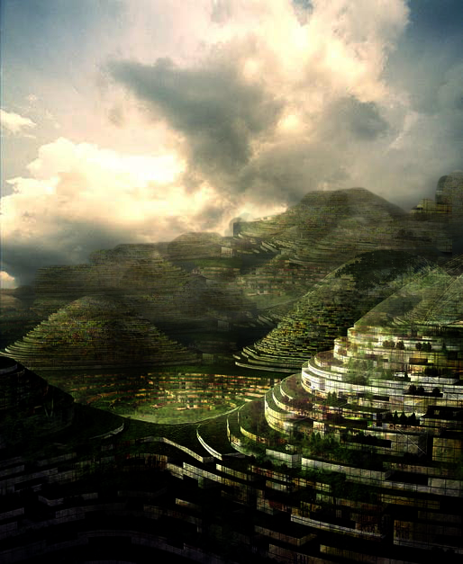
CITY OF SHELLS
Second Term X-Urban Design
EX-Novo City Project
INTRODUCTION
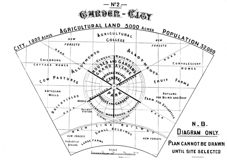
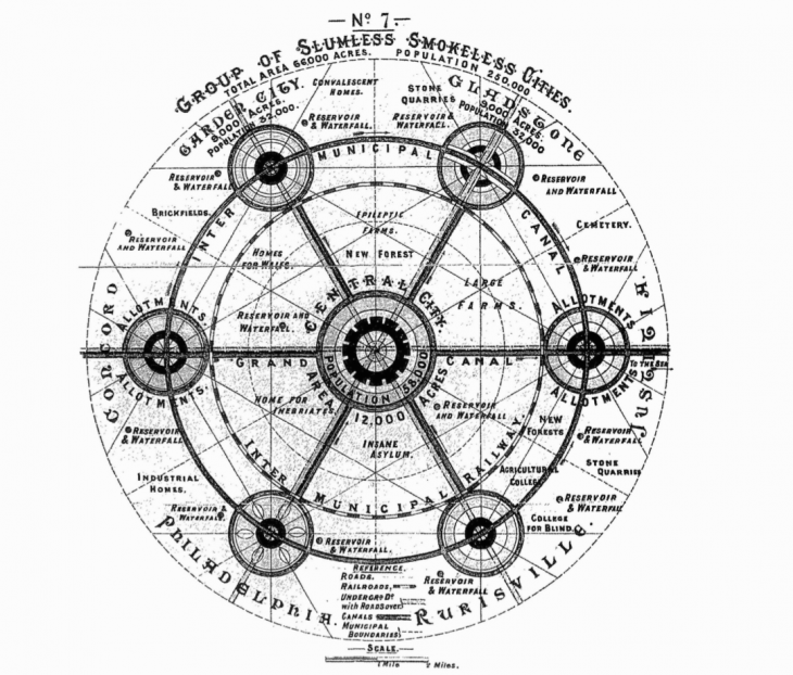
In this second Term, the starting point of the X-Urban design Research line has been the investigation of an assignend case study, In my case it has been “Garden city” the utopic master plan descreibed by Sir Ebanezer Howard in the early ‘900. First all it has been necessary to understand the complexity of this schematic plan looking behind the diagrams adn the guidelines he left us in order to reach the ideology hiidden in that plan more than the pure geometreical shapes of the master planning. This work was crucial to extract the key elements used then in the next step of the project.
“A GARDEN CITY IS A TOWN DESIGNED FOR INDUSTRY AND HELATHY LIVING; OF A SIZE THAT MAKES POSSIBLE A FULL MEASURE OF A SOCIAL LIFE, SURROUNDEND BE A PERMANENT BELT OF RURAL LAND; THE WHOLE OF THE LAND BEING IN PUBLIC OWNERSHIP OR HELD IN TRUST FOR THE COMMUNITY”
-C.B. Purdon
RESEARCH
ANALYSIS OF THE GEOMETRICAL ELEMENTS FROM THE PLAN
The basic scheme for the Howard’s city consists in a central radial grid developed around a system of 6 radial Boulevards and 6 circular avenue. Those system is implemented by a secondary network of roads used to interconect the sectors created by theprimary system of roads. The global network create a grid of lots where the mono-familiar and bi-familiar dwellings take place. The diameter of a satelite city with 32.000 inhabitants is 2.4 km and there are approximately 50 km of roads in each satelite.
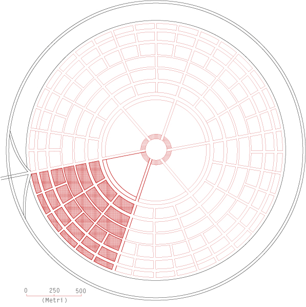
The Howard Master Plan details:
A total Amount of 2429 ha
Divided in:
-2023 ha for the agricultural belt with
1 pop/ha
-405 ha for the central garden city
79 pop/ha
30000 popularion for the main city
2000 population for the agricutural belt
Howard does’not consider the dwelling tipology
he just mentions the ooportunity to have in the garden city:
“… 5,500 building lots of an average size of 20 feet × 130 feet”
ANALYSIS OF THE MORAL PRINCIPLES BEHIND THE UTOPIA
Through The well known Three-magnets Diagrams Howard illustrated the vision of towns free of slums and enjoying the benefits of both town and conutry addressing the question,
“Where will the people go ?”.
He proposed the creation of suburban town of limited size planned in advance and surrounded by a permamnet belt of agricultural land.
Howard believed that such Garden Cities were the perfect blend of city and nature. The towns would be largely independent, managed by the citizens who had an economic interest in them, and financed by ground rents on the Georgist model.
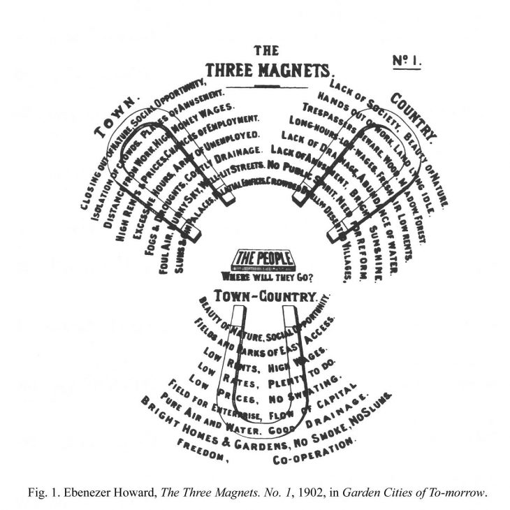
“Town and country must be united, and out of this joyous union, will spring a new hope, a new life, a new civilization.”
-E. Howard
BENEFITS FOR THE CITIZENS DERIVING FROM HOWARD’S IDEAS
Beauty of nature- peace all-over the places.
Social opportunity- cumulative growth.
Fields and parks of easy access- equal chances.
Low rents- high wages.
Low rates- plenty to do.
Low prices- no sweating.
Field for enterprise- flow of capital.
Pure air and water- good drainage.
Bright homes & gardens- no smoke, no slums.
Freedom- Co-operation.
NEW PROPOSAL
More than geometrical features, for the new proposal the moral and ethical aspects have been tacked. In fact “…This project is to ameliorate the limitation of the horizontal expansion by proposing a new high/down rising typology where it enables a compact life style decreasing waste time and optimizing the possibilities of socializing with neighbors by various activities in the same place. This project suggest natural environemnet as an enhancer of satisfaction of life”
New Key features
Complete Self_Sufficiency
Mobility is the core of the city not the boundary
The growing is radial but even vertical
Shorter Distances
The main target will be the explitation of the volume more than the surface
No roads are provided if not green pasagge to connect the dwelling
The connection towards other city of the network will be the only non pedestrians mobility
Exploration of a different kind of verticality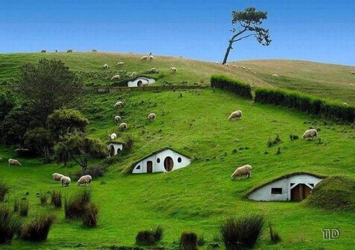
GRID EVOLUTION

The Garden city grid has been reinterpreted in order to find new spatiality and to ensure the fully exploitation of the
volume, It has been done through the stretching of the bi-dimensional grid, vibrating, pinching the ground in order to extrude and extend the surface in all the directions. The reason of this motion depends by the need of looking for a new idea of spatiality that can offer a confortable new place to the human being without to pertutbate the integrity of the nature, increasing the percents of surface used by nature as result of the city growing. Not the opposite.
CUT&SEW…
The traditional topography offers a vertical or horizontal expansion for the citites and the underground solution is not a valid alternative for some well being standards. So how to reimagine the natural topography in somethingother who can serve our purpose ?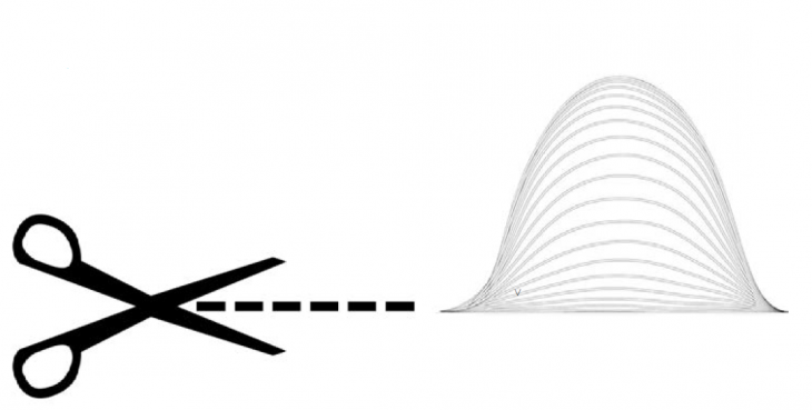
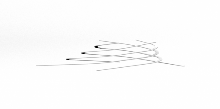
The streching of the grid corresponds to the streching of the ground. Through an artificial sub-strucuture the man kind will just shift the nowaday zero and will inhabit the “in between”.
The 3-dimensions offers the possibility to combine several slopes for several uses in one unique element…
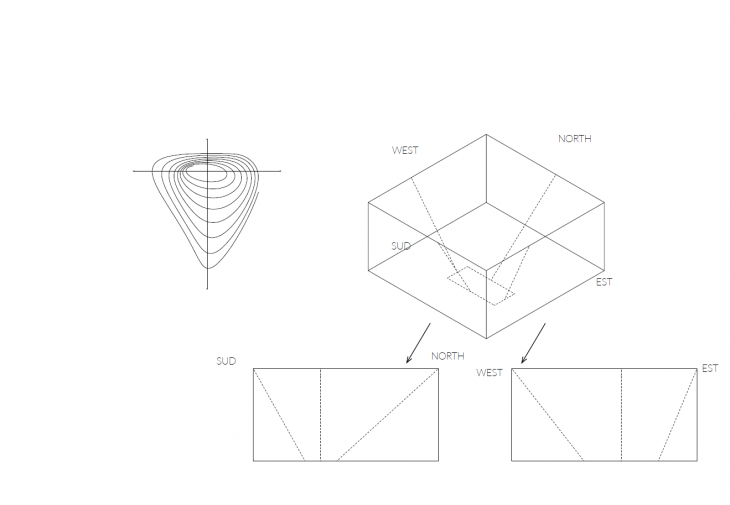 PARAMETRIC MODEL FOR A UNIQUE MODEL
City Growing
According to the onion layering this city will grow embrassing all the spatiality of the 3 dimensionality, So even from initial small settlement, layer by layer the population will grow up till a fixed number.


HABITABILITY
The housing modules can move on the support grid to allow to the sunshine to reach the layers below.
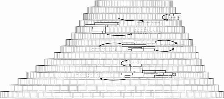
In addition the particular Shape of the aggregation create a chimney effect favoring ventilation.
SECTION & AXONOMETRIC VIEW
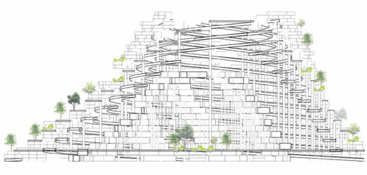
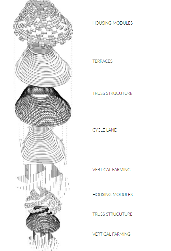
MASTER PLAN COMPOSITION

The elements will be arranged on following the criteria of the Co2 footprint. Each city center will have a disitance beteween each other so that allows the placing of an amount of tree which are able to absorb the Co2 produced by the population. In fact each tree can absorb 17/35 kg of Co2 for year. In one hectare it is possible to plant from 1000 to 2000 trees. For this reason through rough calculation each city should be at least 5 km far from the folowing, The second criteria considers the distance between each center and the facilities, as the waste collector or the sport center, that is possible to share. In addition the last Criteria consiser the “secondary function” of each city, the financial the healthcare the administrative…
THE SHELLS

Top view

Plan schematic
ELEMENTS OF THE PLAN
CITY
Up to 60 floors
Population between 1.000 and 50.000 unit
FARMING
Each module will host 250 ha of harvesting land ditrubuted on terrace to increase the producutuvity adn to prevent the soil erosion
WASTE COLLECTOR
The waste and recycling module will be shared by several cities and wil host even the activities related to the research on new materials
ART and SPORT CENTER
As the Waste collector it will be shared by several cities and will host all the activities related to sport and arts
ENERGY PRODUCTION SITE
Acording to the data related to the energy consumption per capita (8 KW/y) for each city will be provided a solar field of 76 ha

Intended uses diagram
INSIDE VIEW RENDER
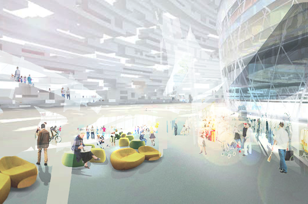
INTRA-CITY MOBILITY
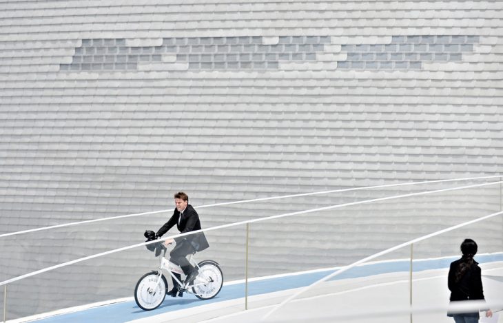
The mobility inside the city will be delegated to the unique cicle lane in the middle. Due to the low slope it will be possible to reach any level bycycling.
Danish pavilion by BIG at expo2010
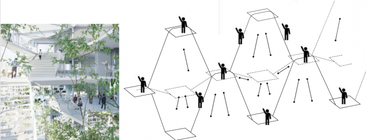
The funicolar will be the way to connect sevral units going up and down thanks to the possibility to reach a maximum slope of 75 degree.
…at the same time the mobiliti on the outside surface will be delegated to a system of stairs arranged with different slopes and connecting the dweling thanks to a system of extruded platforms.
INTER-CITY MOBILITY

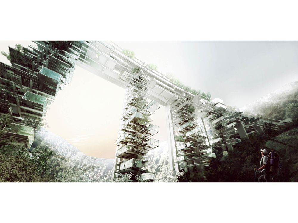
A System of rails will connect up and down all the cities. Those rails will attach straight to the cycle lane of each city. Several vertical farming placed according to the structural need will serve as supports for those rails.

Two cities view

Overall front view

Vertical Farming Pillars
RENDERS
WELCOME TO CITY OF SHELLS…