‘ECO-DELHI’
An approach for ecological urbanism within high densities.

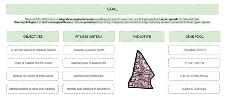
The project ‘Eco-Delhi’ aims to integrate ecological urbanism as a design principle for new urban morphologies amidst the urban sprawls of north-east Delhi. New morphologies that aid the ecological tissue of cities are prioritized by providing more green space and improving connectivity between residential blocks and green spaces. The main tools used in this optimization are Grasshopper and Wallacei X plugin for the optimization process.
PRIMITIVE PHENOTYPE

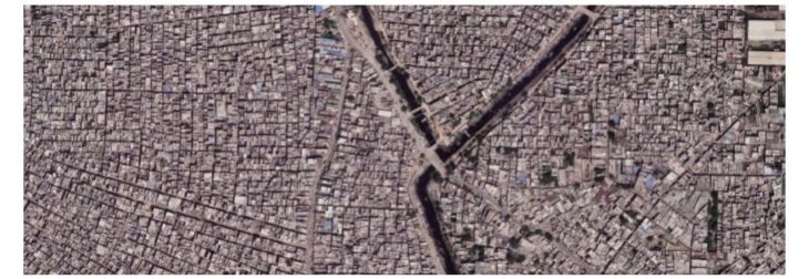
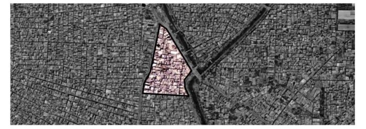
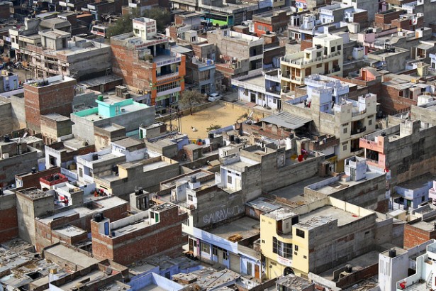
In the recent decade, Delhi has witnessed rapid urbanization and urban population growth resulting in rampant urban sprawl. The North East of Delhi particularly is a highly sprawled district. It primarily has residential housing typologies with a density that can go up to 11,500 people per square kilometre. It is seen that Delhi city is undergoing urban sprawl with exponential growth at the core and conversion of rural areas into urban patches at the periphery. Our understanding of the present morphology tells us that high densities have resulted in little to no vegetation within the neighbourhood fabrics, lack of open spaces such as parks, gardens, recreational zones, the streets are densely occupied like an amalgamation of pedestrian and vehicular infrastructure. Keeping this in mind, we choose a 0.5 km. sq block within the fabric of North-East Delhi, with interesting boundaries that connect to varying typologies.
EVOLUTIONARY MATRIX
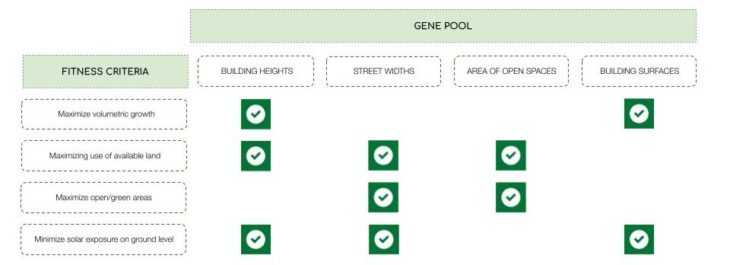
The project is based on the following fitness objectives determined by the analysis explained above. These are maximize volumetric growth, maximize use of available land, maximize open spaces, and minimize sun radiation on ground level for the residents of Delhi. Fitness objectives are linked to genes, which are the parameters used to define or measure the range of the intervention to be performed. The Evolutionary Matrix explains how each gene controls each fitness criteria.
THE RESULTS OF THE EVOLUTIONARY SIMULATION
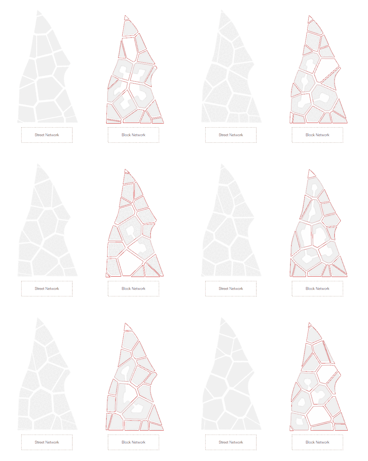
The key for us in generating new morphology was to follow the classical planning parameters, which we believe need some fundamental alteration, namely, ‘The street network’. We wished to achieve a more efficient iteration of the organic layout prevailing in east-Delhi streets. Our street networks aid in generating our plots to create residential blocks. The blocks are created from the offsets of street widths to choose plot that maximize the area as much as possible. Further, we categorize blocks on the basis of size, and carve the larger block introducing a series of green networks within them.
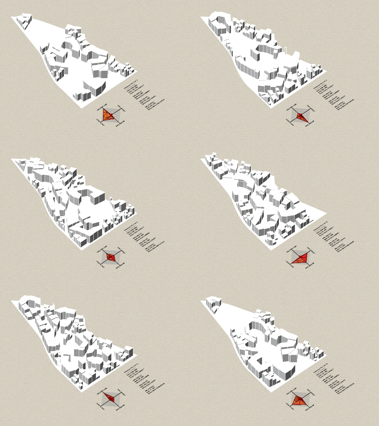
Moving forward, each plot is broken down into clusters of buildings. The operating logic is is to maximize the volumetric growth to accommodate densities in the urban realm, as we open spaces up for the community. This is where we work with the building heights. Some of our iterations do maximize the open areas, however, given the urban conditions of Delhi, we understand that there is to be a more balanced approach to even providing open or green spaces. An interesting addition here could be working with specific proximities, which is a line of research we would pursue with more time. However, under the present constraints, this slide presents a complete visualization of all our results. Here we observe the pareto front from the last generation which fulfil the fitness criteria as the maximum. The diamond graph we see here changes quite a bit in each iteration, most of them are skewed in one direction.

The PCP helps us visualize the relationship between our fitness objectives. Rationally, these objectives are classical planning parameters that are complementary in nature. However, our simulation illustrates that across the fitness objectives there is a difference in the spread, with some clustered and some not. What is particularly interesting is the lack of difference from the first to the last generation, as this raises some interesting questions regarding the fitness objectives as parameters themselves. The black line on the graph is the average of the fitness ranks.

This is our catalogue. It illustrates all our generations, moving towards the maximum of the specific fitness objectives we have chosen. Visually, some of them are iterations that could not ideally be incorporated into a fabric like the suburban east Delhi. The open spaces in our iterations have an arrangement that can definitely be further curated. In some of our results we can observe a great balance of open and occupied spaces, with a efficient street network that is hierarchical in nature. These results have been studied further to understand how each fitness objective is being met and where do we need to take our study further.
PRELIMINARY ANALYSIS

Here we have some graphs organised by our four fitness criteria. From the standard deviations graphs the results were a bit surprising; overall there was not a big shift across the generations, the most significant being the first two fitness objectives. For the fitness value graphs there is quite a lot of noise for all of them, characterised by heavy spikes and the spread across all four fitness objectives is relatively equal. The last row depicts the optimality graphs; these four graphs are the optimal option for each of the fitness objectives respectively. From this we can see that when one fitness objective is optimal it is often accompanied by high optimality from another fitness objective, making our iterations relatively complimentary in nature. This is supported by the previous PCP shown and the other graphs showing here which show a lot of similarities between fitness objectives.
GENOMIC SEQUENCING

This is our genomic sequencing. As we observe at the end of the sequence the colours start to repeat more, indicating that Wallacei is forming and generating patterns. The clustering is more clear in some fitness criteria and not so clear in others. These patterns indicate that the evolutionary algorithm is trying to achieve the optimal result according to our fitness criteria.

SELECTED URBAN MORPHOLOGY
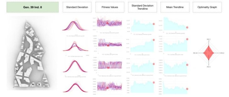
Here we observe one specific example just to look at the complete set of graphs for one iteration. We see similar results here to the results of the overall analysis, with the characterization of even distribution of smaller and larger blocks as is typical for Delhi.
CONCLUSION
Given the scope of our current work, we would like to lead this project and add another objective that closely curates proximity of open spaces, this would allow us to create better models for the present urban conditions. Our criteria were initially selected so that they can complement a greener Delhi, in efforts to reduce the current levels of air pollution, however our selection of fitness criteria regarding integrating specific objectives and genes with respect to maximizing open spaces and maximizing available land use give us contrasting results than we hoped for and there is an inherit conflict that arises from the objectives from a space allocation perspective.
‘Eco-Delhi’ is a project of IAAC, Institute for Advanced Architecture of Catalonia developed in the Master in City & Technology 2021/22 by Students: Can Xu, Julia McGee, Parshav Sheth, Yohan Wadia and Faculty: Milad Showkatbakhsh