ABSTRACT
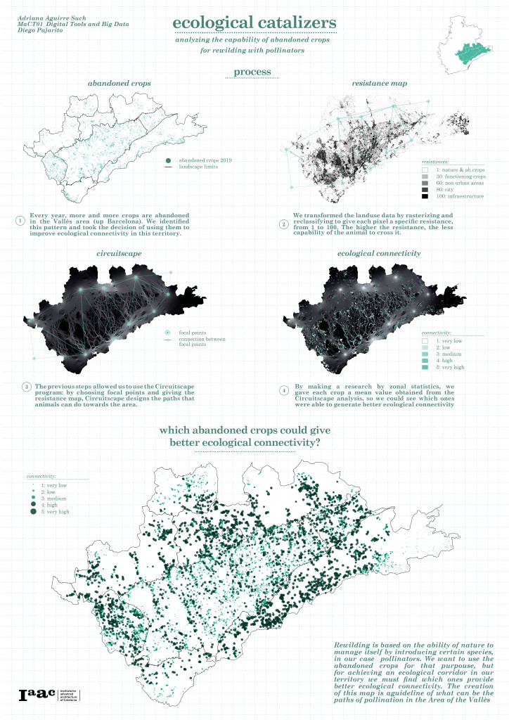
Rewilding is based on the hability of nature to manage itself by introducing certain species, in our case pollinators. We want to use the abandoned crops for that purpouse, but for achieving an ecological corridor in our territory we must find which ones provide better ecological connectivity. The creation of this map is a guideline of what can be the paths of pollination in the Area of the Vallès.
INTRODUCTION
The effect of landuse change in our landscapes has generated a a real negative impact in biodiversity and wildlife, as these landuses never have attempted to undestand how nature and its habitants could be part of our ecosystems. Our linear economy and way of production has degradatet both anthropic and non anthropic habitats by the continuous generation of waste, not only in an objectual way but also in an spatial way: Humans continuously abandon spaces that afterwards are hardly recovered.
abandoned crops & resistance map
METHODOLOGY
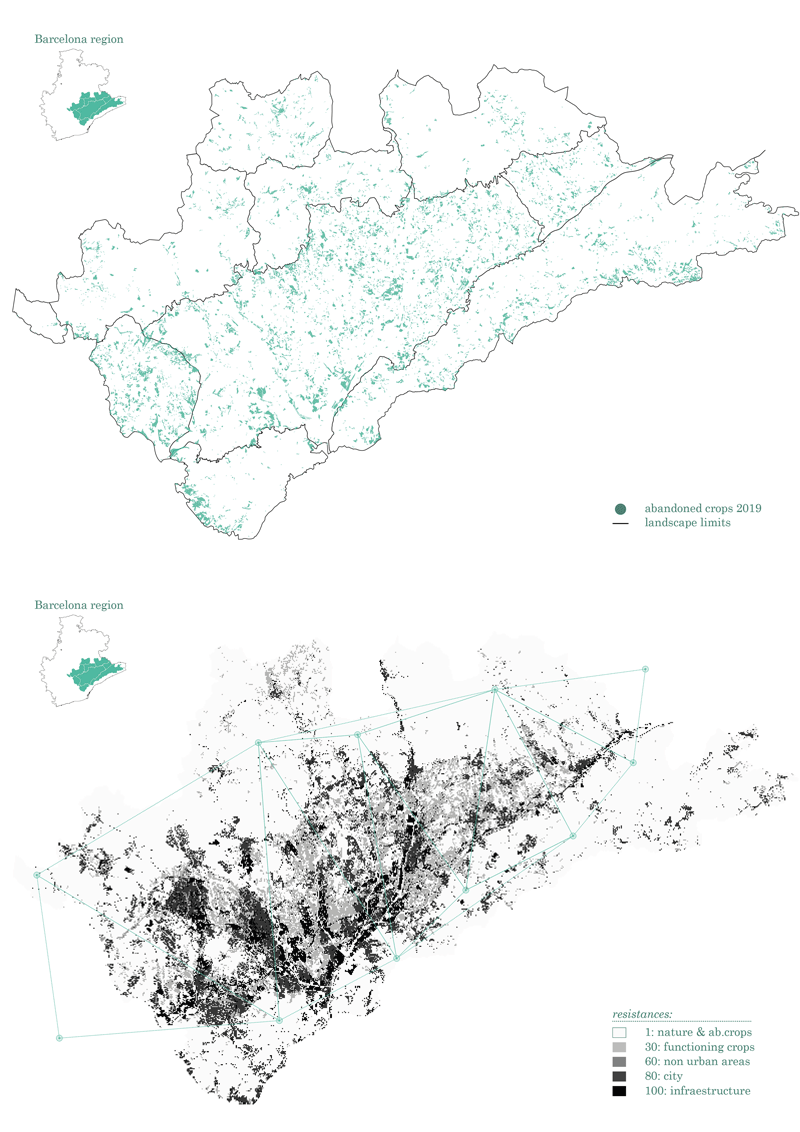
Every year, more and more crops are abandoned in the Plana of Vallès, located in the south part of the region of Barcelona. We identified this pattern and took the decision to use them to improve ecological connectivity in this territory by creating spaces that could enhance pollination habitats and the ecosystem services that they provide.
Taking into consideration the effects of landuse, we used the data by rasterizing and reclassifying it to give each pixel an specific resistance, from 1 to 100. In this way we could determine which areas were harder for animals ; the higher the resistance, the less capability of the animals to cross them.

Circuitscape map & abandoned crops ecological performance
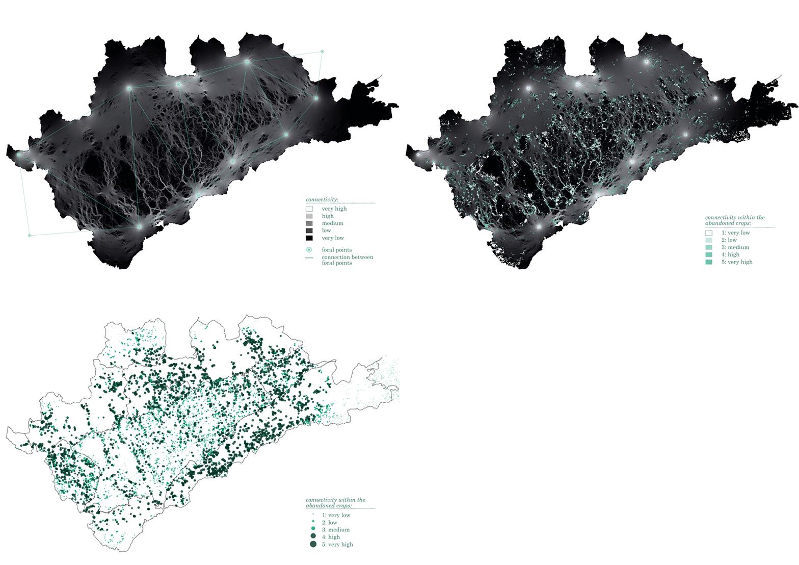
The previous steps allowed us to use the Circuitscape program: by choosing focal points and giving the resistance map, Circuitscape designed the paths that animals can do towards the area. This paths crossed the abandoned crops of the territory with different kind of intensities so in order to understand which ones were more suitable to generate ecological connectivity we used zonal staticstics. By this step each crop received a mean value of the raster file depending of their performance.
CONCLUSION
By using Big Data tools we can improve our processes of analysis, procedure, design and communication; by using information as a key element of our processes, the accuracy of the results are undeniable. We can actually determine which will be the best paths for our pollinators based on real data about ecological connectivity and choose the areas that provide better circumstances for our goal.

Source: Institut Cartogràfic i Geològic de Catalunya
Ecological Catalizers: connecting the Vallès is a project of IAAC, Institute for Advanced Architecture of Catalonia developed at Master in City & Technology in 2020/21 by student: Adriana Aguirre Such, and falculty: Diego Pajarito
