RE(NATURING) BCN
DEFINING | THE PROBLEM & SCALE
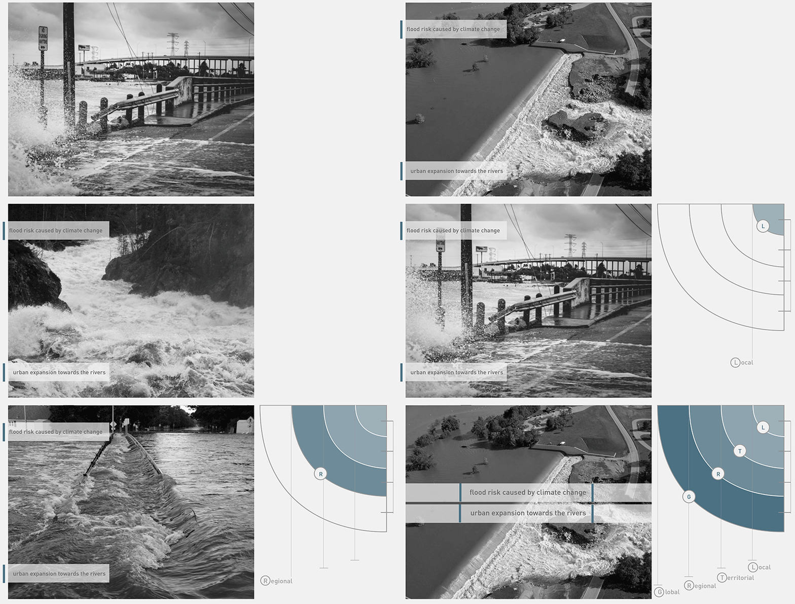
Project is built upon two main problems at a global scale: flooding caused by climate change and urban expansion towards rivers. Both the problems, and proposals are defined and developed based on different scales that can be followed as global, regional, territorial, and local.
NATURE BASED SOLUTIONS | RENATURING
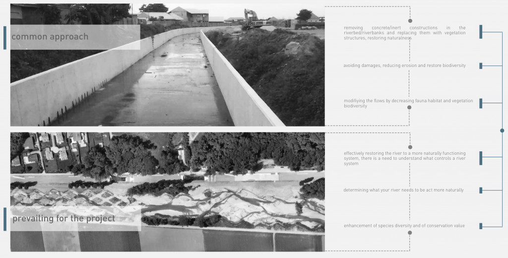
There are a lot of concepts and approaches to the renaturing process; but renaturing for us is to effectively restore the river to a more naturally functioning system.
CASE STUDY | REVIEW
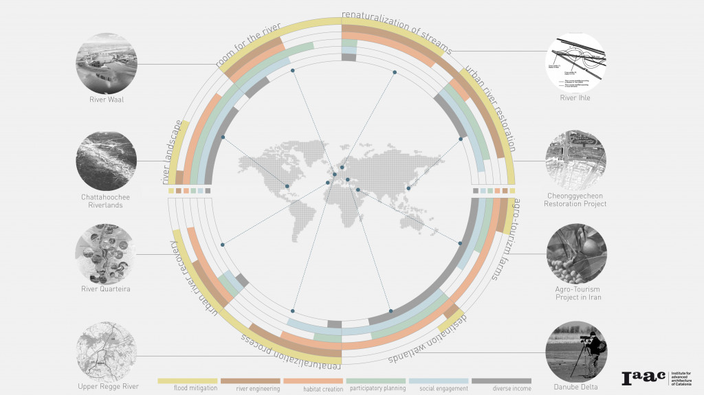
In order to come up with a synthetic approach of own own, we studied different case studies of renaturing around the world and evaluated them based on a set of parameters that we then use to evaluate our own project.
LLOBREGAT | RIVER ANATOMY
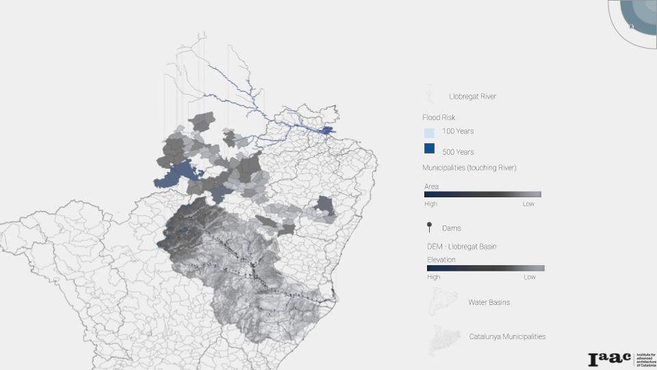
Our challenge was to do a river renaturing project in the area of Barcelona, so we chose to work with a river that has the critical problems previously defined in our case study analysis. We selected to work with the Llobregat River in Catalonia. It is an 170km river with large flood risk areas, that affect many Catalonia municipalities, not just Barcelona. Moreover, it has dams all along its course, representing a river with high human intervention.
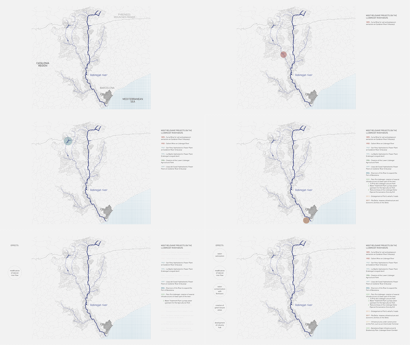
THE STORY OF A RIVER
The Llobregat river starts in the mountains and ends in Barcelona, where it flows into the Mediterranean Sea. Countless projects have happened and continue to happen along its river basin, so here we presented the ones that affected or will affect the river the most, such as the creation of park projects. From these main projects, the most relevant effects were the water salinization from the salt mines, the several modifications on the natural river flow, the contamination of the water with fertilizers from agricultural lands but also positive effects such as the creation of smaller green leisure and conservation areas, and the development of an industry hub on the lower part.
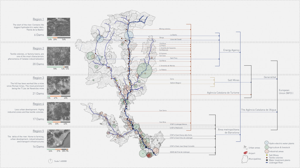
STAKEHOLDER | ANALYSIS
Starting from the main projects and going deeper in the analysis of the river, by first dividing it in five regions according to their common characteristics and the river shape, we identified the stakeholders that control the Llobregat. We were able to conclude the high influence the agricultural and industrial areas (green and orange circles) have on the river, as well as some entities and facilities controlled by the Metropolitan Area of Barcelona and the Catalan Water Agency, and even the Airport and Port of Barcelona, which flank the river on both sides of its mouth and strengthen the agriculture and industry hub of the lower Llobregat.
LLOBREGAT | RISKS & OPPORTUNITIES
Based on mapping studies and analysis we did, we summarized the main risks and opportunities this river provides allowing us to clearly point out five sites where most of of the risk and opportunities are concentrated. We opted for working with the last one- the Llobregat Delta which contains a conservation zone, agricultural park and industry hub with the airport. In the Delta, Barcelona’s desire for expansion meets farmland of immense economic importance, while it also faces water quality issues brought down stream from mining facilities. All of these issues play out in a territory that has been recognized as being of exceptional ecological value.

EXPANSION | TOWARDS THE DELTA
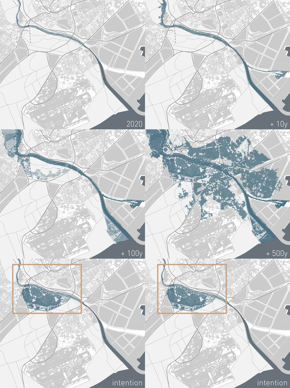
The below image illustrates how Barcelona’s expansion toward the Llobregat’s Delta has encroached upon the historic floodplain. The diagram allows us to comprehend the extent of the flood risk in the area. It is worth noting that, due to Climate Change, the existing flood risk is expected to increase throughout the next century. This helped us define our project area. While the Llobregat poses many problems and challenges throughout its length, it is in its Delta where its most pressing issues intersect. While the challenges are complex, the opportunities for meaningful change are also present.
METHODOLOGY & APPROACH
Considering the complexity of our project, we have developed a series of analytical processes that have helped us transform our analysis into design parameters. Each part of the procedure is tasked with either transforming information into a decision or in transforming a decision from one scale of intervention to another
COMPETITION | IN THE DELTA
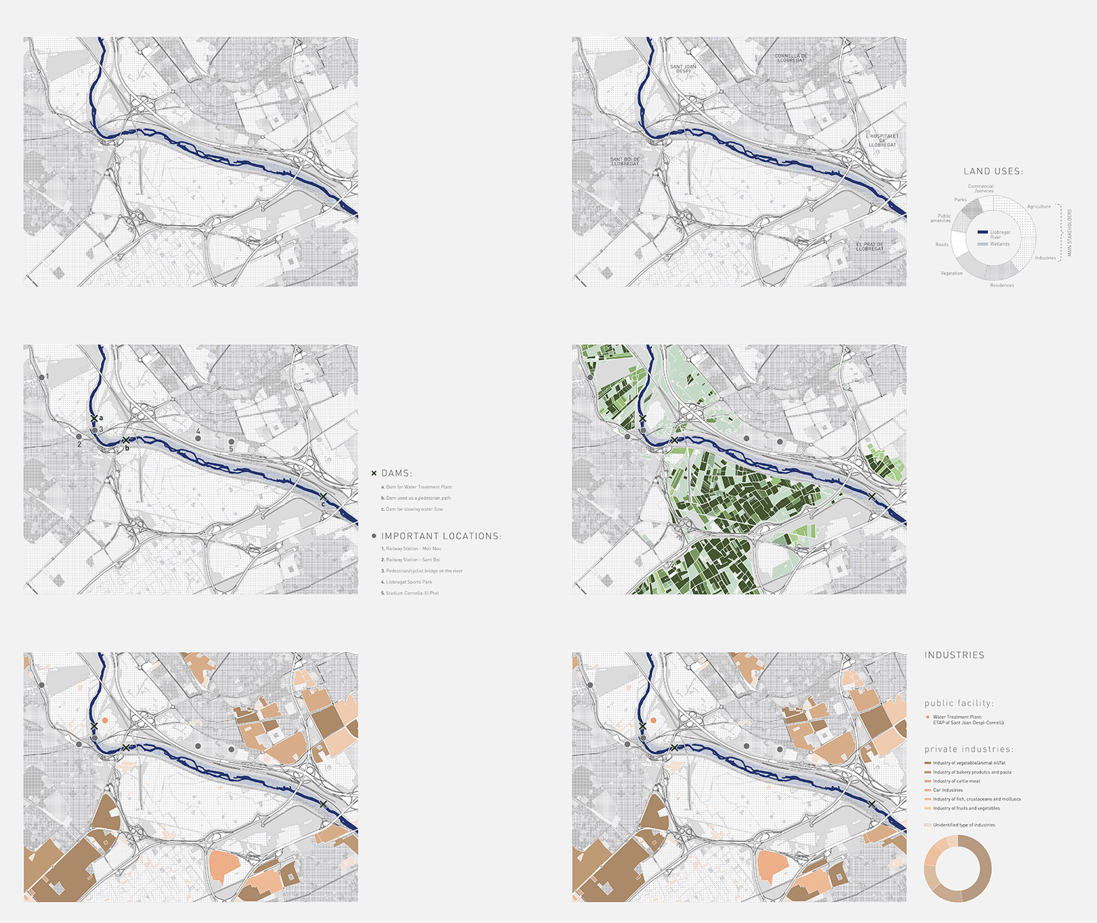
The area of intervention was studied deeper by analyzing the land use and also identifying the important infrastructure that exists on site The land use analysis provided us with the conclusion that this area is predominantly agricultural followed by industrial. We were also able to identify that the kind of agriculture that exists on the site is dedicated mostly to horticulture.
SIMULATIONS | CAESAR
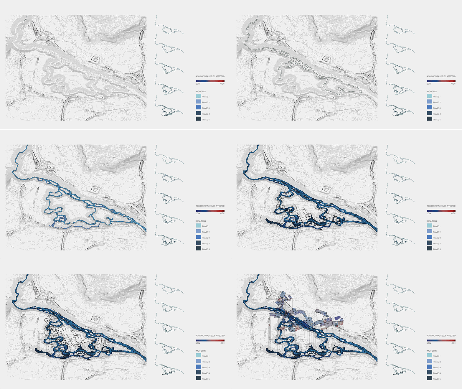
We used a simulation program that allowed us to visualize how and where the river would potentially flow over different time spans, and naturally the landscape starts to form wetlands, at this point we also identify that this new meandering will have an impact on existing agricultural areas.
CAUSES | EFFECTS
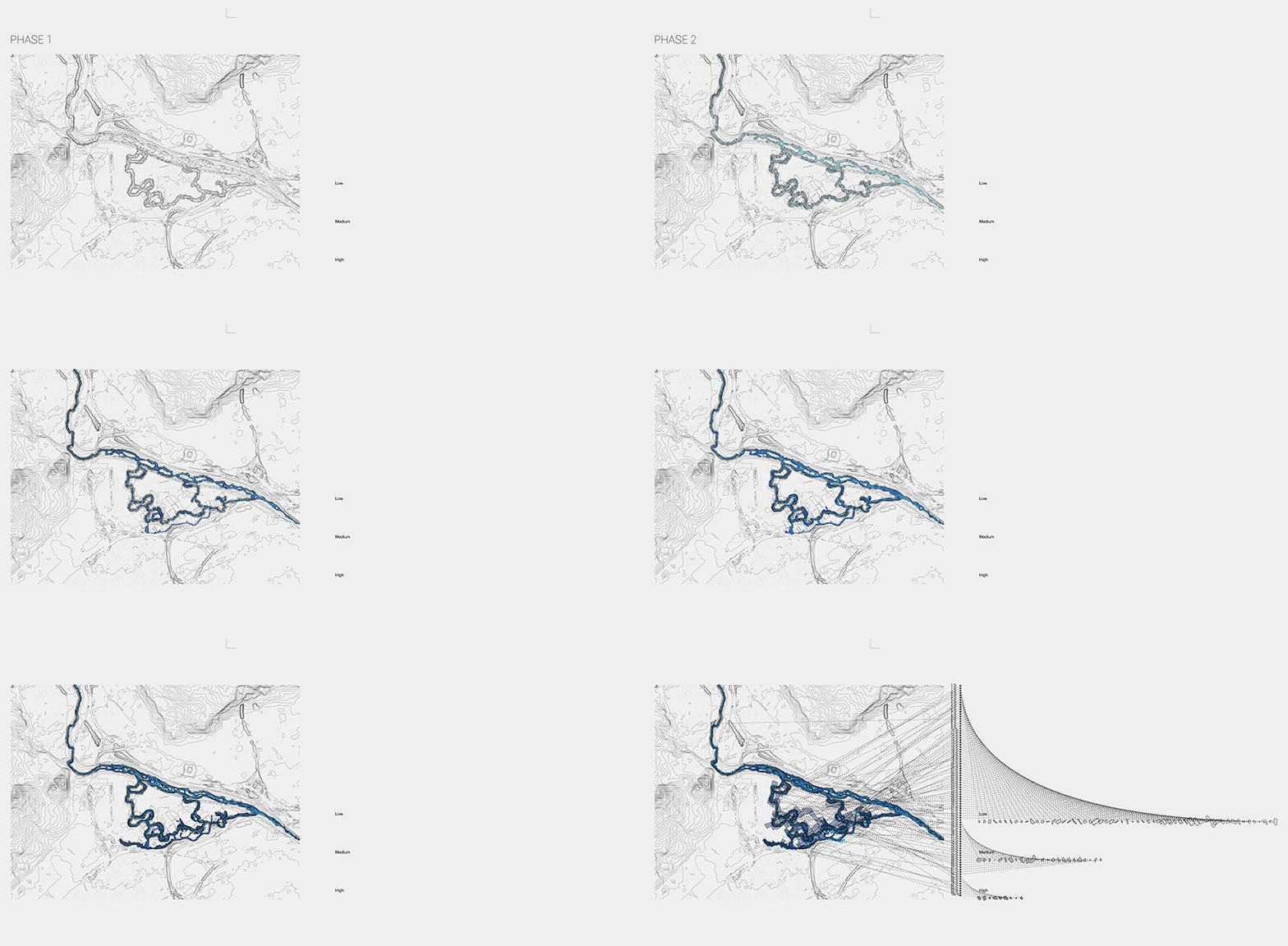
Further calculations were done to identify by how much the agricultural fields will be affected by the new river meandering in each of its phases. This was done in order to guide the potential adaptations scenarios that could be presented to the affected farmers.
DESIGN | PROPOSAL
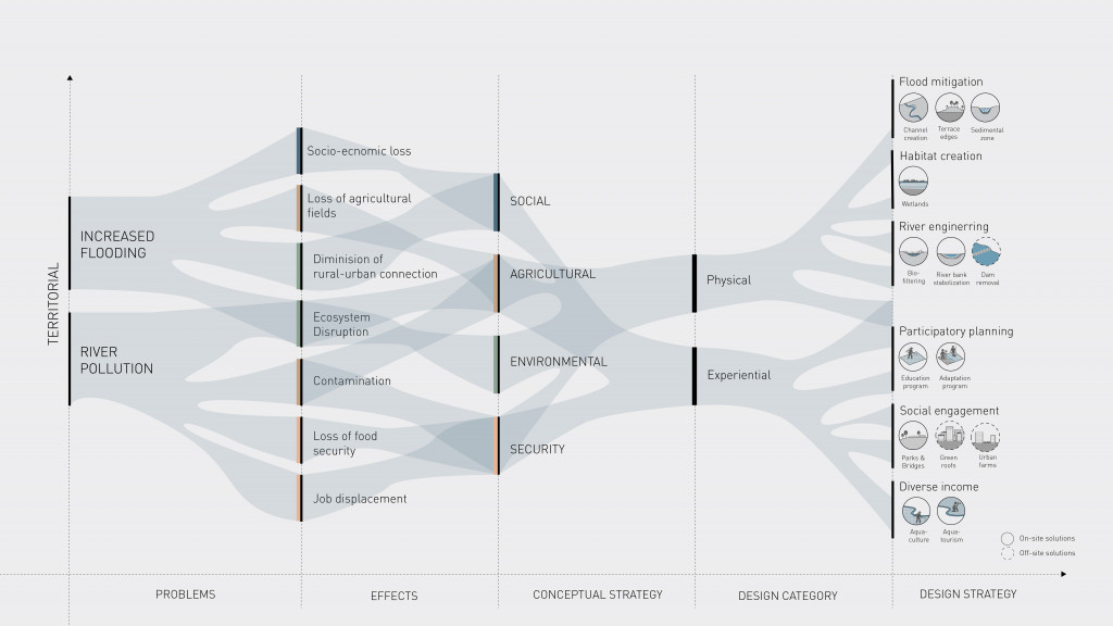
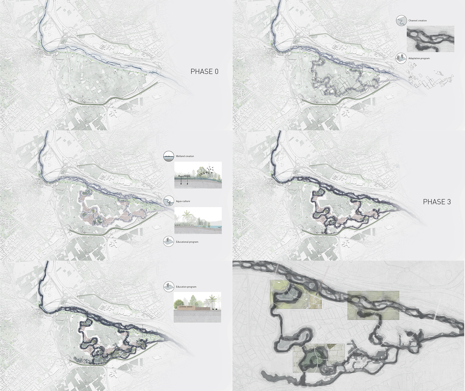
The process begins with blocking the water with terrace edges to prevent the flow of water towards surrounding urban areas. Then we start to see the first meanders and the formation of a new channel. In the first phase, wetlands provide new habitats for flora and fauna and at the end of this phase, an educational program is proposed that trains the farmers affected. With the formation of more water bodies and changes in the landscape, we start introducing river engineering mechanisms such semimetal zones that help control river flow and erosion levels. As time passes, the river starts taking up more land and creating more meandering. So at this stage start to introduce bio-filtering mechanisms and also introducing off-site solutions that will allow compensations for the loss of food production by introducing urban farms in different available voids in the city. This further strengthens the connection of the citizens with food production and to the site itself. Once the river bed is stabilized, we can focus more on engaging the public by creating agricultural educational programs and aqua-tourism programs that will help fund the maintenance of the wetlands. Finally, we can begin to focus on community building by designing recreational areas connecting rural and urban and open the site for the public engagement.
THE ENHANCEMENT OF A SYSTEM
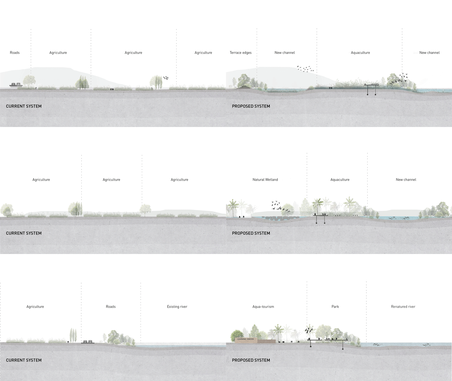
Having identified the affected farms we started looking at potential adaptation programs. Firstly, while the channels are being formed AMB (metropolitan area of BCN) could compensate these farmers for the temporary land loss through tax benefits and Education programs. Secondly, the farmers would be a part of the decision making process By choosing one of the suggested scenarios. For example; Least affected and medium could choose to stay on their land or merge with another farm. While the highly affected are equipped with tools and knowledge to switch to aquaculture on the new wetlands formed. The scenario on the right is a long term vision of the new food production system where the river functions as a link connecting the people to agriculture.
AN INTEGRATIVE APPROACH TO RENATURING
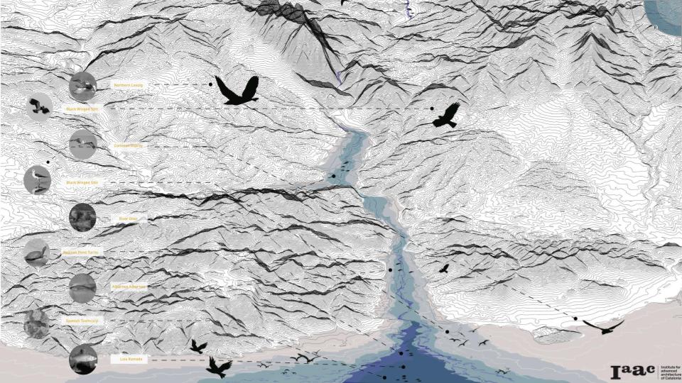
Our proposal recognizes the Deltas importance as a resting spot for migratory birds and as a place that connects amphibious species throughout the River, Our proposal aims to provide new habitat for the species that have historically been displaced and affected by anthropogenic activities. In this illustration, we Identify some of the most recognized species as well as their usual habitats within our study area.
LLOBREGAT | TODAY & TOMORROW
So what is the future of the Llobregat? By applying these strategies on different sites on the river we can begin to witness both upstream and downstream changes in landscape and an area of monoculture is suddenly turned into a diverse area of opportunity.
THE FUTURE OF LLOBREGAT
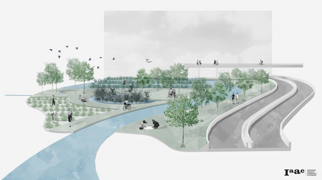
To conclude, this collage represents how we envision our area on the next years, the river linked to the city and to food production, with regular farming – on the bottom left – and aquafarming – on the top left – coexisting side by side with a park for the people all along it, with wetlands and a very natural green infrastructure. And it’s a concept that could be reproduced on other similar sites along the river course, promoting an actual river renaturing by addressing the elements this river and its surroundings need to improve in order to act more naturally.
Re(naturing) BCN is a project of IAAC, Institute for Advanced Architecture of Catalonia developed at Master in City & Technology in 2020/21 by student: Aishath Nadh Ha Naseer, Hebah Qatanany, Laura Guimaraes, Mario Jose Gonzalez, Sinay Coskun and faculty: Eduardo Rico, Mathilde Marengo & Iacopo Neri
