SantiaGO
Future Mobility
The development of Santiago, Chile as seen on the map is radial in fashion and job densification is mainly found at its center. Many of its residents, often have to travel large distances every day in order to reach the workplace. One particular spine of the city, named Route 68, connects the urban center to different residential clusters.
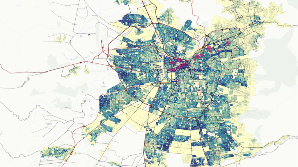
Densification of Santiago, Chile
A future plan for the improvement of Santiago’s transport was conjured – a plan which involves the use of autonomous vehicles for the efficient facilitation of a large population that constantly moves huge distances in particular time periods of the day. Furthermore, in 2018, an estimated number of 60,000 passengers go to Santiago International Airport per day. By 2050, the airport will incur an increased 140,000 passengers per day. The need for a commercial area and residential area becomes increasingly apparent with this increased foot traffic. With the goal of converting people’s preference for private cars to public transport, development plans for two new districts will be discussed.

Santiago Future Plan
Super Spine
The foremost consideration in the development is ensuring the efficient connection between the urban center and the 2 new districts. The Super Spine transport model for Santiago will involve the adoption of the Railless Tram. The conversion will ensure a cheap alternative which is flexible in terms of ride frequency/ interval as well as route designation. In particular, the frequency will adjust depending on the demand. This will result in the better apportioning of resources which will, in turn, save both money and time. Having flexible stops will also constitute the same benefits if implemented in a coordinated manner. The railless tram extension will have to merge seamlessly with the existing metro transport so that mobility is uninterrupted.
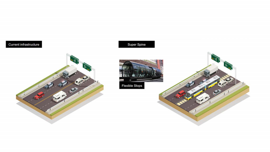
Super Spine Transport Model
New Residential DistrictWith the successful implementation of the Super Spine, increased population due to the development of a new residential district will be manageable. The new residential district which will be located along Route 68 will hold 100,000 residents.
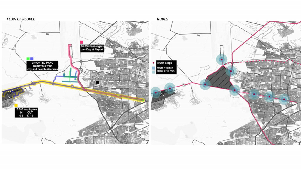
Santiago New Neighborhood Plan
High-density mixed-use structures will be the active frontage along route 68 and with medium to small residential-use structures towards the inner portions of the district. A designated neighborhood transport system will circulate passengers within and also connect to the Super Spine model.
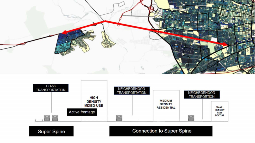
Santiago New Neighborhood Plan
New Innovation District
With the upgraded transport network, the area will be increasingly urbanized in the coming years – and even more so with the airport extension. This, coupled with start-up and innovation accelerating programs, a new innovation district that can provide jobs and commercial activity is set to be developed. A potential location for this area is adjacent to Route 68 and within proximity to the airport. 3 nodes define this area into a triangular shape. As such, the usual box grid will be set aside in favor of a diagonal one. Similar to the new residential district, an internal transport system of autonomous public vehicles will circulate the community. These internal transport system will also connect with Route 68 as well as the main road that leads to the airport.
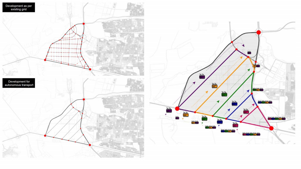
Innovation District Autonomous Transport System
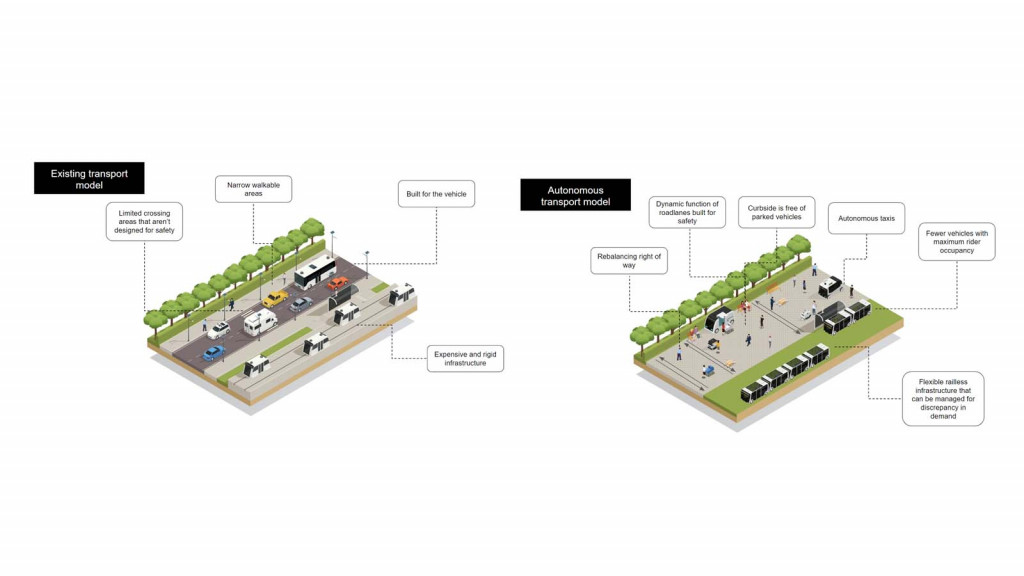
Innovation District Autonomous Transport Model
With the use of autonomous vehicles transport can become more efficient and space-saving. Time can be managed more efficiently by improving vehicle coordination and eliminating demand discrepancies. And, this way, larger areas can be allotted for pedestrian use and enjoyment.
SantiaGO: Future Mobility is a project of IaaC, Institute for Advanced Architecture of Catalonia
developed at Master in City & Technology in (2019/2020) by:
Students: Jochen Morandell, Andrew Saltzman, Kushal Saraiya, Rovianne Santiago
Faculties: PhD Gaia Sgaramella & Giuseppe Vallelonga