As we go into more and more mobile and interconnected future the boundaries physical and imaginary blur. Thus we shift towards the world of cities from the world of countries. What if we could see and compare what different measures, techniques and methods implemented elsewhere and the results they yielded in terms of qualities of public spaces? Could we potentially avoid stepping on same rakes over and over again? Or could developing cities skip unnecessary and often painfully costly to the environment and to the budget steps? Could we make urban development grow exponentially faster? To address these questions among other by a team led by Vicente Guallart, IAAC founder and former chief architect of Barcelona city – here in IAAC has been introduced the platform urbanization.org.
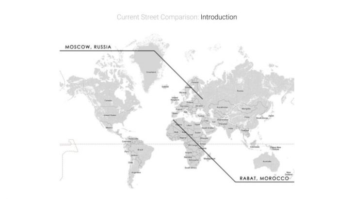
World Map – Wide Street
With this in mind and a slogan of “The Science of Making Cities” in the course of Urbanization we set to collect and compare information on streets from all around the world. Hence, the course consisted of two stages:
1. collect and measure data of three streets of your native city;
2. group up by street typologies and compare different aspects of public space.
As a result of the comparison the task is to develop an estimated guess on what immediate steps are to be implemented on the streets in context of the issue in question. Our team investigated two streets: Leninskiy avenue in Moscow, Russia and Annakhil avenue in Rabat, Morocco.
Reference
To begin with, the most relevant urban developments in the direction of wide streets as opposed to regular streets can be interpreted and thus rethought of as a combination of linear and local planar qualities. Thus most of our inspirational references were less focused on first aspect as it is far more researched with various speed management techniques, safety and transportation improvements and so on.
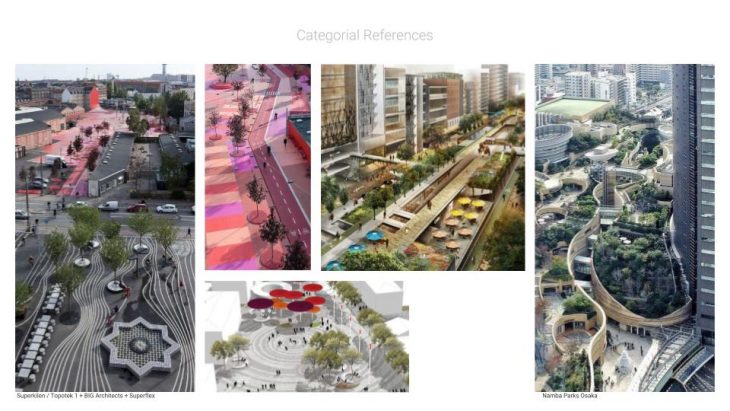
References – Wide Street
Comparison
Despite being in completely different geographical and climate zones and also with different historic, social and cultural backgrounds both selected streets have a lot in common.
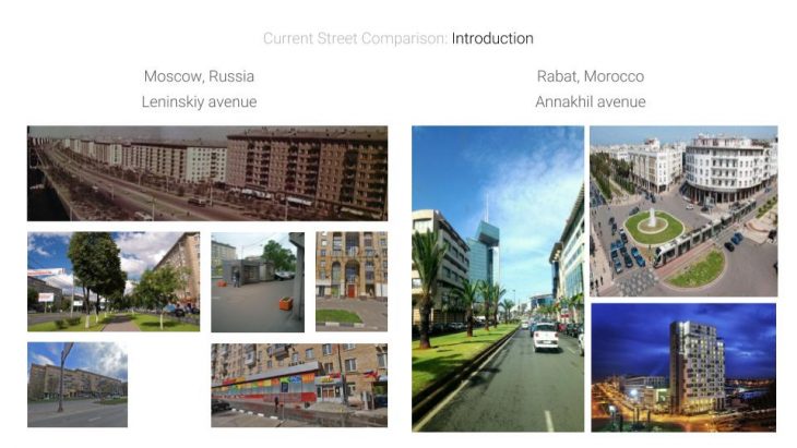
Comparison Pictures – Wide Street
Both streets are relatively new and play a huge role as a transportation axis in cities. Both have historical ties to bold and audacious ideologies (one is built from scratch as a solution for housing problem, another is a standing monument to colonial period).
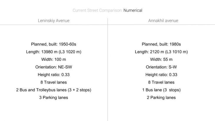
Comparison Numbers – Wide Street / Urbanization.org
Proposals
Street 1
At first, in analysis of Leninkiy avenue certain key detrimental current conditions revealed themselves:
- poor functionality of local lanes – being used a placeholder for overflow of mane lanes in traffic worsening conditions;
- purely residential character of the districts around with little to none social public platforms;
- even more, low performance of public transportation system: low accessibility of metro (in-between two parallel lines), disrespect to dedicated bus lane rules with low fines;
- shift in needs and demands of street users since street design with no structural changes;
- as a result of increased avenue usage there is high noise and air pollution for local residents.
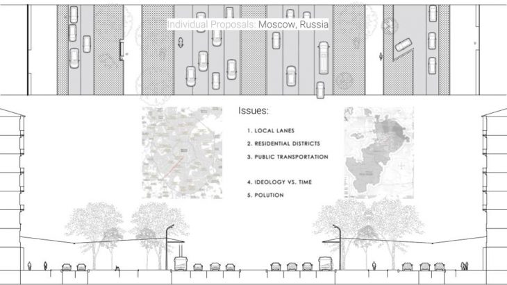
Proposal 1 Current State – Wide Street
Thus the measures focused on addressing these issues with a synchronized adaptive model: shift in levels would allow safer environment and more attention to people as main street users, condensation of public transportation in potentially high-speed tram system to complement metro system and allow better connection between historic city center and newly attached parts of the city, concentration of car traffic with same-level short-term access to houses, temporally shift-able division on top of new levels to break down canyon wind and shield from noise of unfortunately necessary car connection.
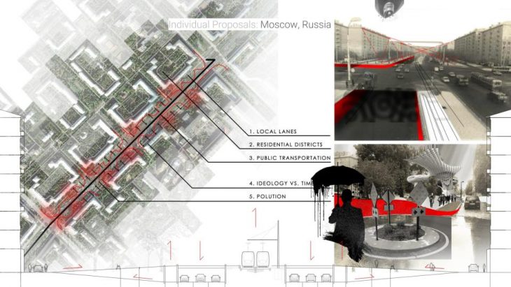
Proposal 1 – Wide Street
Street 2
On the other hand, Annakhil avenue became the administrative and commercial central avenue of Rabat replacing Mohammed V avenue. The avenue has been recently renovated the street has lots of structural improvement. For instance, with the introduction of strategy of roundabouts as speed-dampeners and seamless traffic management, spread of purely pedestrian sidewalks with terraces and active commerce.
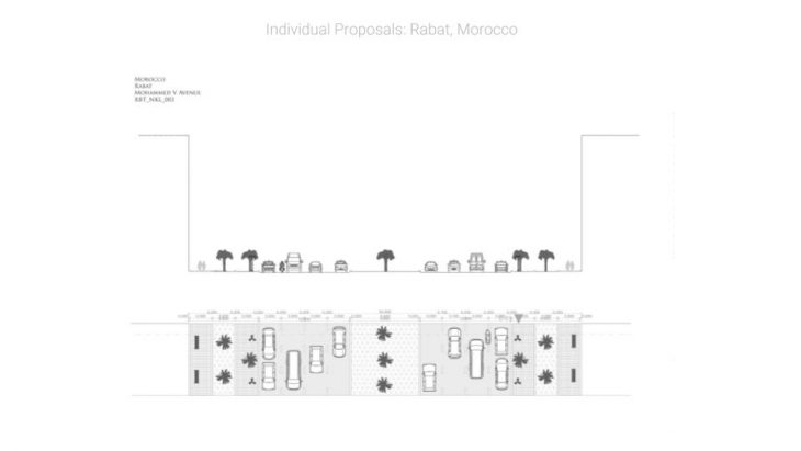
Proposal 2 Current State 1 – Wide Street
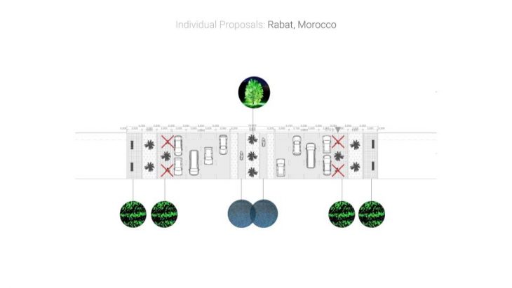
Consequently, more technological aspects of the solutions are in focus. Firstly, activating the space further for people by introduction of important missing element: a network of bicycle lanes.
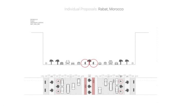
Proposal 2 part 1 – Wide Street
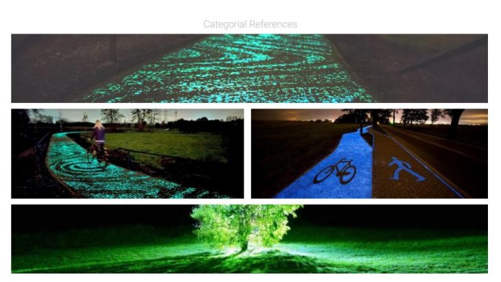
Secondly, as the name from Arabic translates as palm trees, the proposal addresses rethinking of the role of vegetation in the street by introducing new smart function to it. There are a lot of recent tests and prototypes using a glow-in-the-dark bio-luminescent materials and genes. Moreover, they require no additional electrical input and remain completely ecological. Introducing such powders to vegetation and pavement can also increase accessibility as a main night lighting focus remains on the roadbed for cars.
Proposal 2 part 2 – Wide Street
Proposal 2 part 2 reference – Wide Street
Result
Proposals – Wide Street
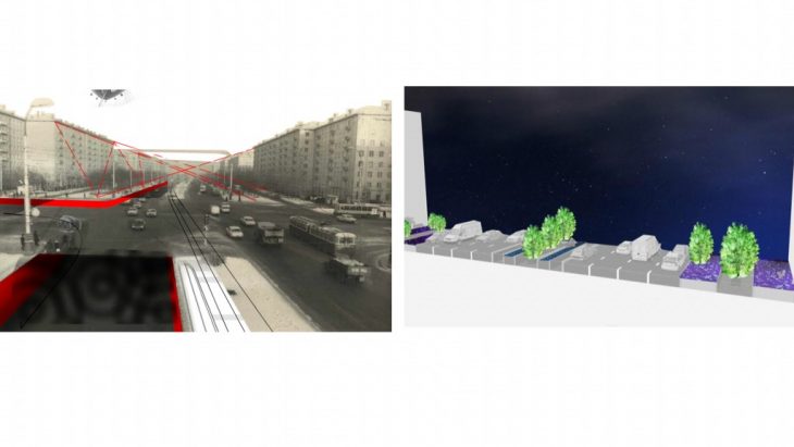
To sum up, as our cities grow more and more we need to keep them growing in the right and not the easy direction. The main user of public space is always the people. Thus, no mater the conditions the hierarchy of street use should reflect that. Sometimes to radically improve the structure or the performance of the space (or even both) we can use technology. However, in the end we have to react to the potential that is there and not blindly follow perfect guidelines and well-trodden paths.
_______________________________________________________________
SE.3 Urbanization.org // A project of IaaC, Institute for Advanced Architecture of Catalonia
Developed at Master in Advanced Architecture in 2018 by:
Student: Daniil Koshelyuk, Tawnza El Moujahid
Faculty: Honorata Grzesikowska
Advisor: Vicente Guallart