ABSTRACT
The purpose of the project “WIDOK” is to create a new elevated pedestrian framework that can define new relationships between the existing historic buildings and the landscape in Krakow. Currently, the urban fabric is fragmented into different systems that have no clear combination in between; some of these systems include the historic city center and existing open space. The disconnection of these elements generates a fragmented city that lacks urban character, particularly in the public domain. To reduce this fragmentation, cultural activities can be implemented into the existing fabric, creating new landmarks that function as a link between art, nature, history, and the city.

Program Weaving Diagram
SITE SELECTION
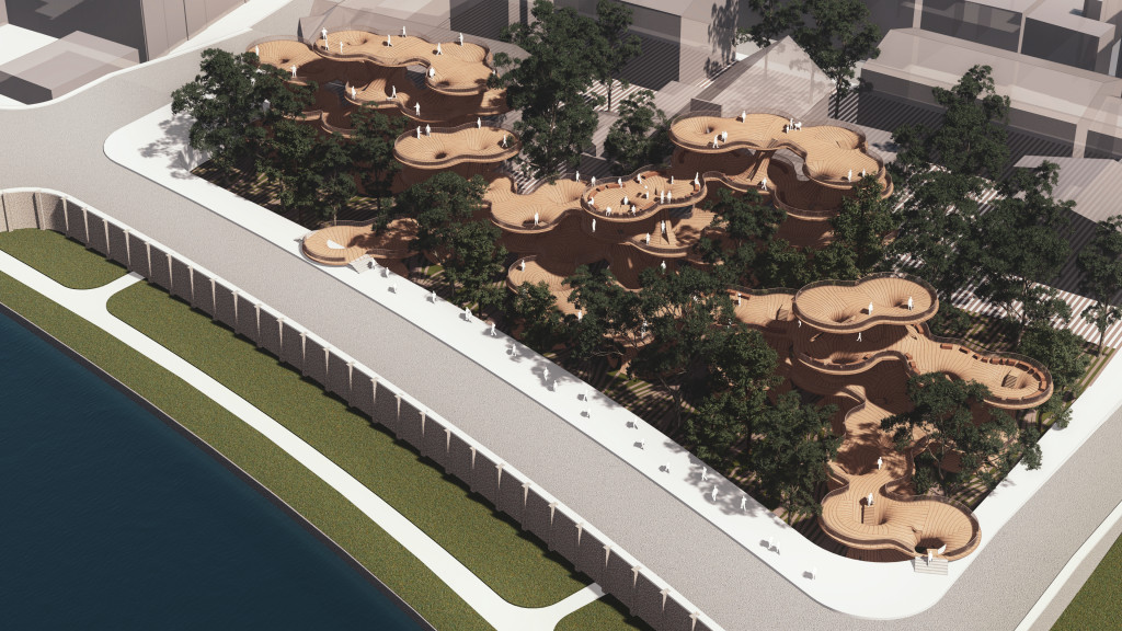
In this project, we are seeking to transform an existing abandoned park into an active and playful place, where people can enjoy multiple outdoor activities, interact with nature, and observe the historical peaks inside Krakow. An empty park in front of the Vistula River and in the middle of Krakow’s historic areas was selected to be transformed into “Widok Park”.
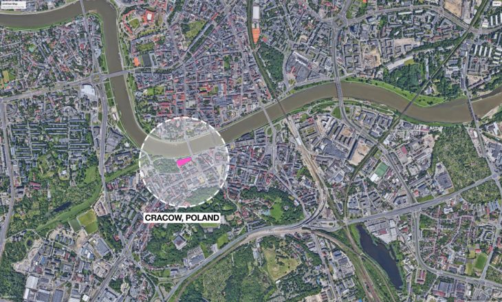
Site Location
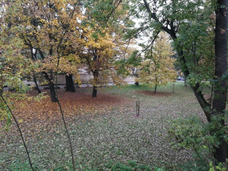
Site photo for the abandoned park, Krakow, Poland
URBAN ANALYSIS
- The site has proximity to 3 different light rail stations within 10 minutes walking distance.
- The closest light rail station is on Legionow street that connects directly to the city center.
- The site is within walking distance (10 minutes) to two urban plazas that include Rynek Podgorski and Plac Niepodleglosci.
- The subject site is located opposite Plac Wolnica that is located on the southside of Kazimierz (historical district of Krakow). This indicates the historical significance of the site to the urban development of the city.
- The green infrastructure around the site highlights 3 main open spaces that provide vegetation to the city. This includes Park Bednarskiego (south), Nowackiego (east), and Cisy na Bulwarze.
- On the other hand, there different green areas, particularly along the river that lacks character and pedestrian activation incurring into unpleasable spaces to the city.
- Krakow’s main blue element is the Vistula River; the river divides the city from the historic center to the most recent urban area.
- Moreover, it can be highlighted that there is a significant amount of green open space along the river that lacks pedestrian activation and relationship to the city.
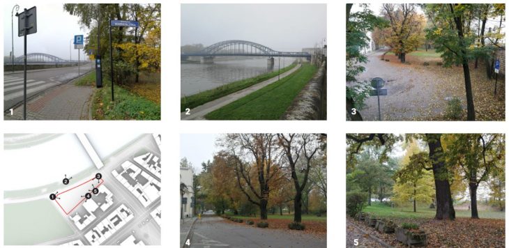
Site photos keymap
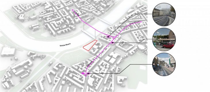
Public Transportation
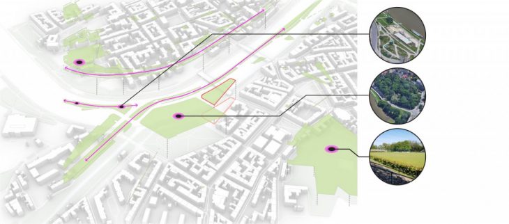
Green Infrastructure
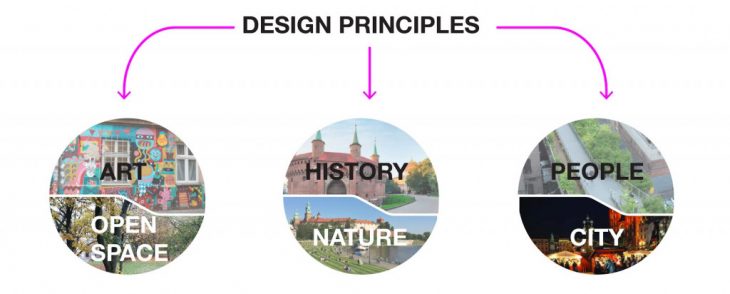
DESIGN PRINCIPLES
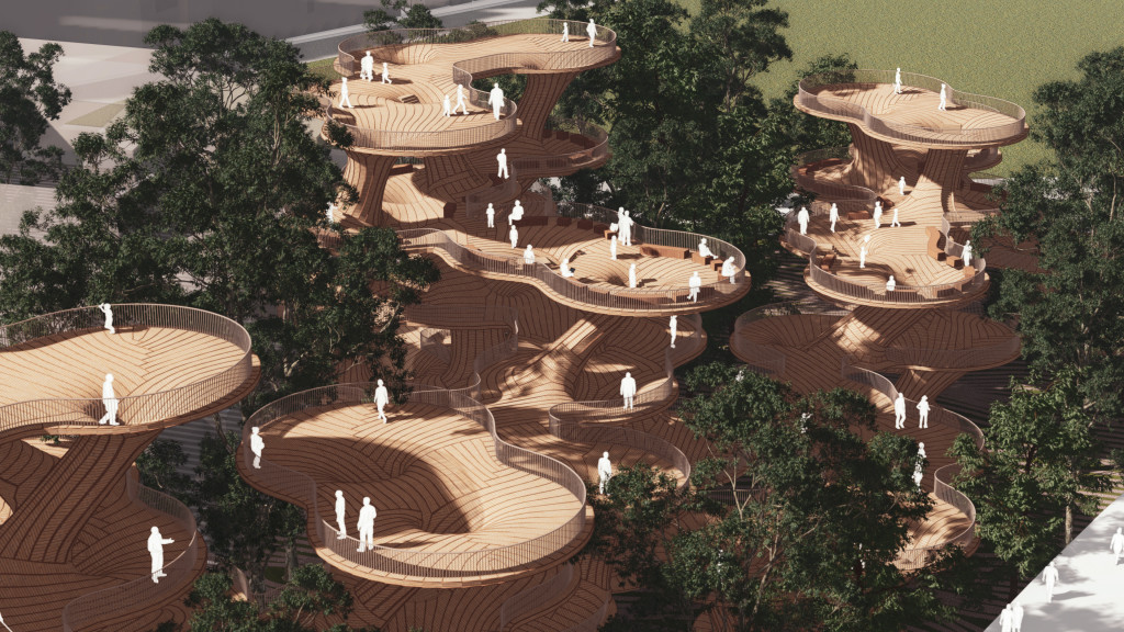
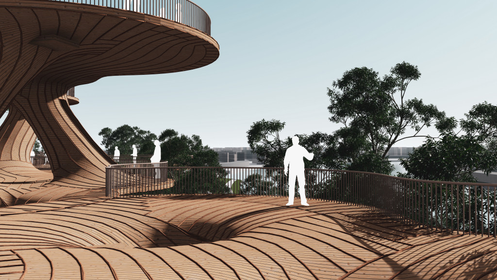
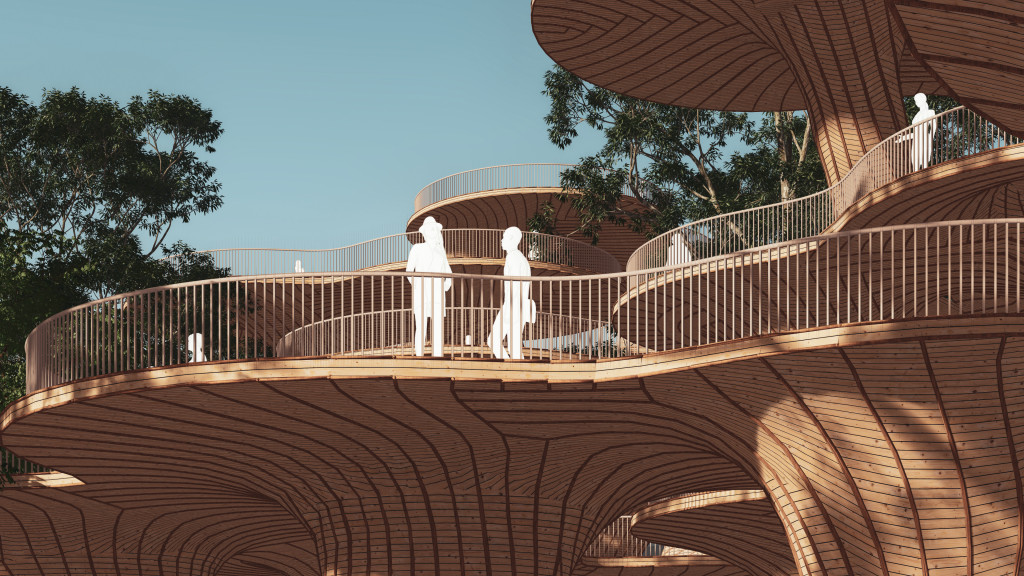
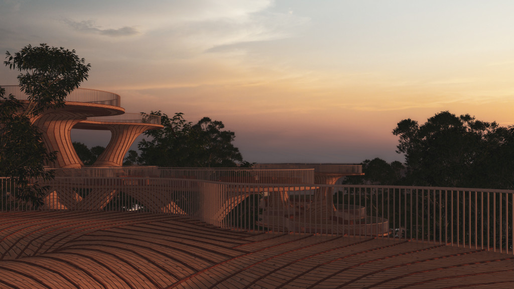
The project Introduces an art/cultural character to the existing open space to enhance the interaction between people, nature, and valuable historical structures. Through people’s movement through the elevated platforms, they will escape daily life routine and enjoy the new and playful experience.
DESIGN PROPOSAL
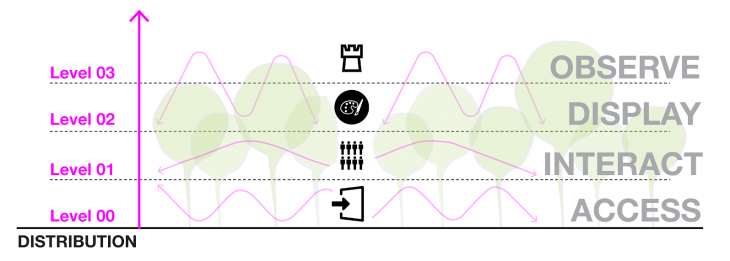
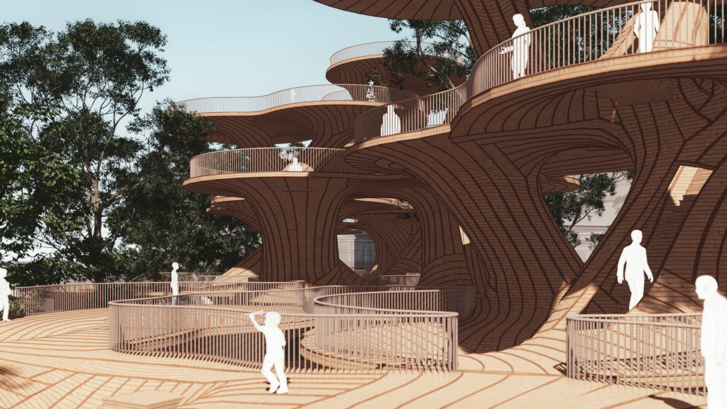
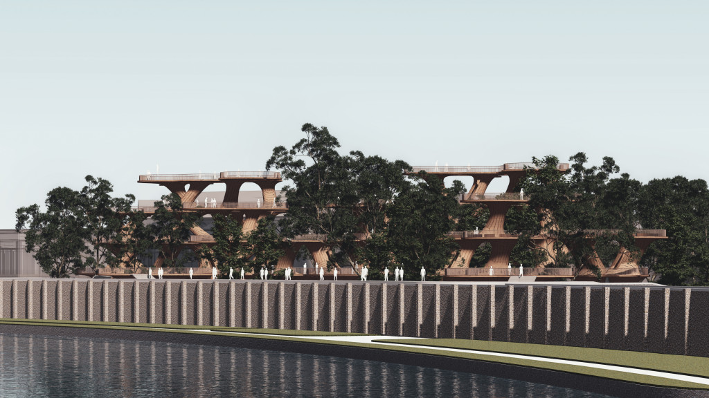
We propose a new peak point inside Krakow which will be created by a series of elevated platforms and landscape structures that lead people movement from different urban nodes to our proposed structure.
The new structure will be divided into four levels based on what people should be interacting with at each level:
Level-01:Accessibility
Level-02:Interaction
Level-03:Display
Level-04:Observe
MINIMAL SURFACES EARLY EXPLORATIONS
In the early stages of the designed process, we explored Minimal surfaces using Grasshopper3d and Kangaroo (physics simulation plugin). In mathematics, a minimal surface is a surface that locally minimizes its area. This is equivalent to having zero mean curvature. The purpose of using minimal surface is to have continuous and well structural performing geometries.
COMPUTATIONAL DESIGN PROCESS
This project establishes a new computation design process based on the following steps:
1-Creating an initial grid that defines where the structure can grow vertically.
2-Stacking low poly geometries with a different number of vertical elements on top of each other.
3-Forming minimal surfaces platforms based on soap film experiment.
4-Establishing structural analysis to create a feedback phase inside the design loop.
5-Establishing environmental analysis to create a feedback phase inside the design loop.
6-Vertical elements clustering.
7-View optimization to control platforms height and orientation.
8-Module details
01-INITIAL GRID
To ensure vertical elements connections and spatial relationships, circle packing is proposed as the initial grid for the structure based on hexagonal cells, existing tree locations, and pedestrian entrances.

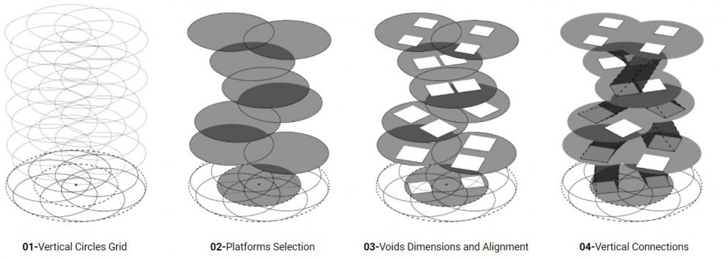
02-STACKING LOW POLY GEOMETRY
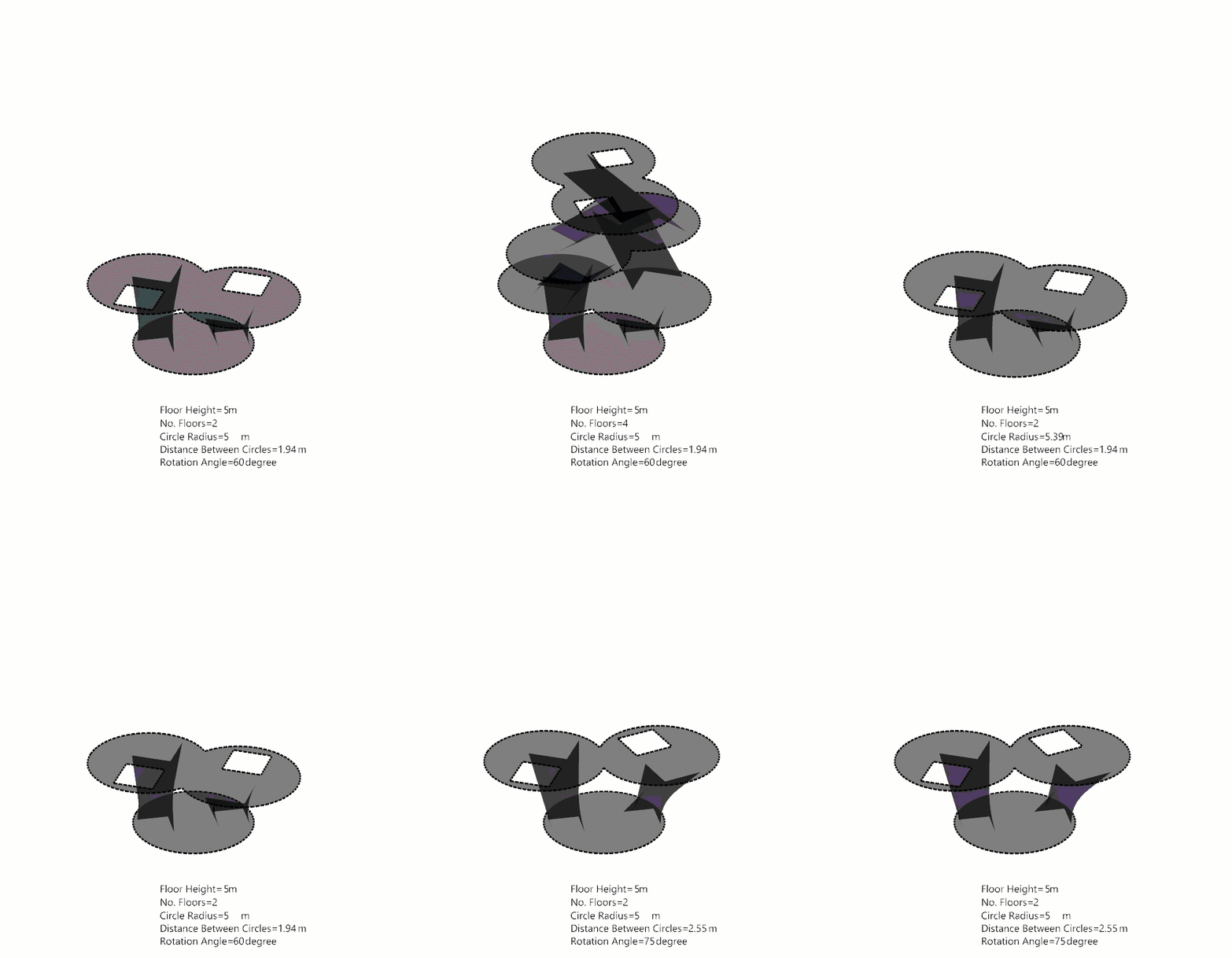
Vertical structures low poly geometry follows these parameters:
01-Vertical Circles Grid
02-Platforms Selection
03-Voids Dimensions and Alignment
04-Vertical Connections
03-GENERATING MINIMAL SURFACES
Based on the initial platforms and vertical connections we create minimal surface geometry. This allows us to create continuous surfaces for the structural force flow as well as achieve a visually interesting structure. Minimal surfaces are being generated following “Soap Film Experiments” rules, using Kangaroo inside Grasshopper3d.
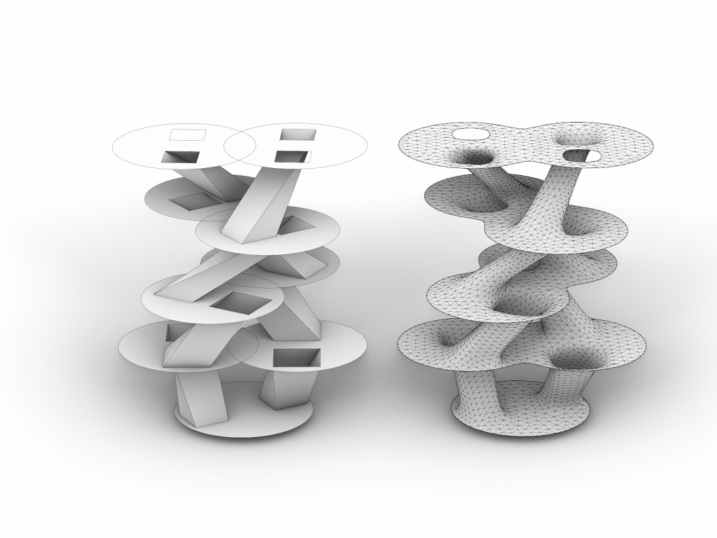
Low poly geometry vs minimal surface
04-STRUCTURAL ANALYSIS
The geometry of the elements as well as their height and rotation has been driven by structural and environmental performance as well as by consideration about the visitor experience regarding the views on the city. First, the massing model has been meshed to create a structural system following minimal surface geometry. Steel tube elements are used to provide adequate structural performance. First, one module was analyzed for gravity and wind loads. The displacement of the module due to wind has proved to be quite high, around 40 cm. In order to limit the deflections, different variations of module clustering have been evaluated. In conclusion, a configuration with only one level of module higher than the neighboring one is chosen as acceptable.
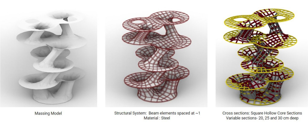
Structural Analysis Setup
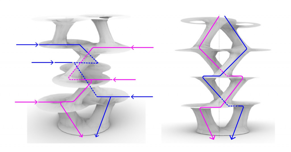
Force Flow Diagram
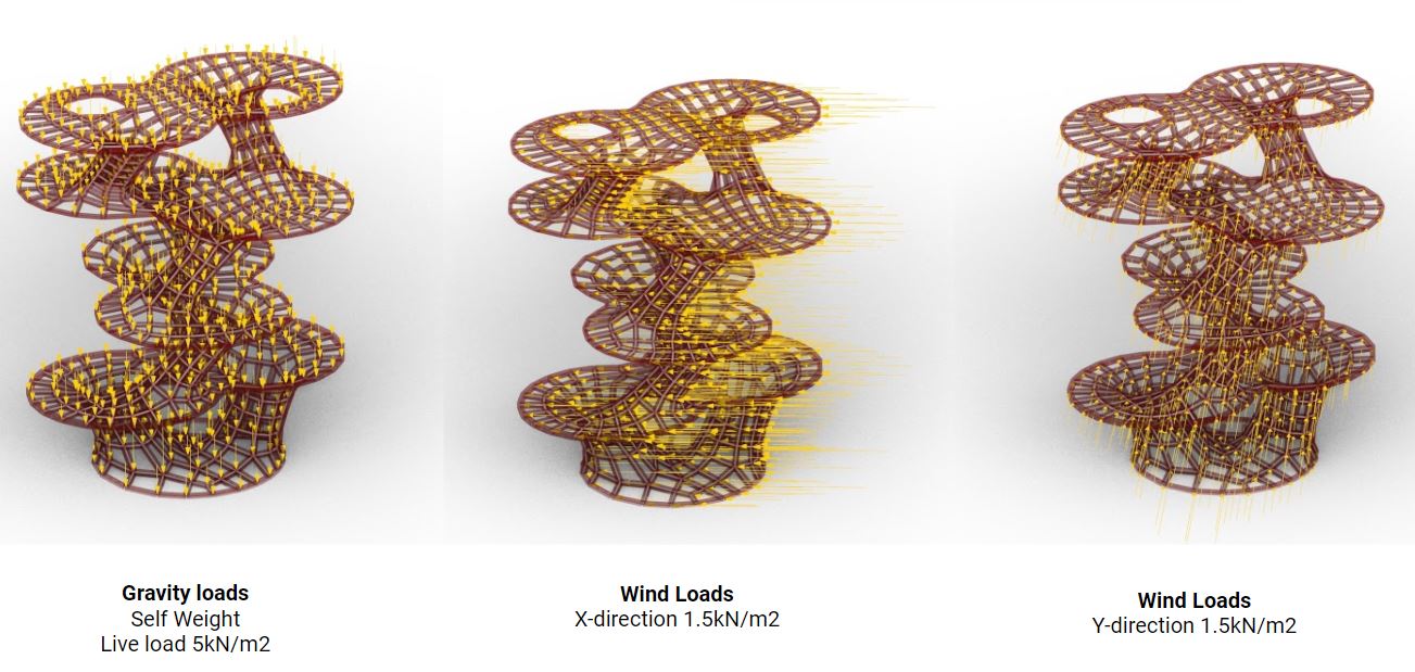
Structural applied loads
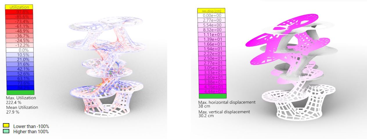
Member utilization/displacement-gravity and wind loads
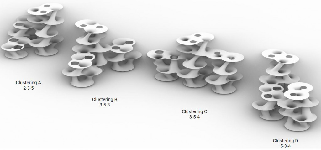
Geometry clustering iterations
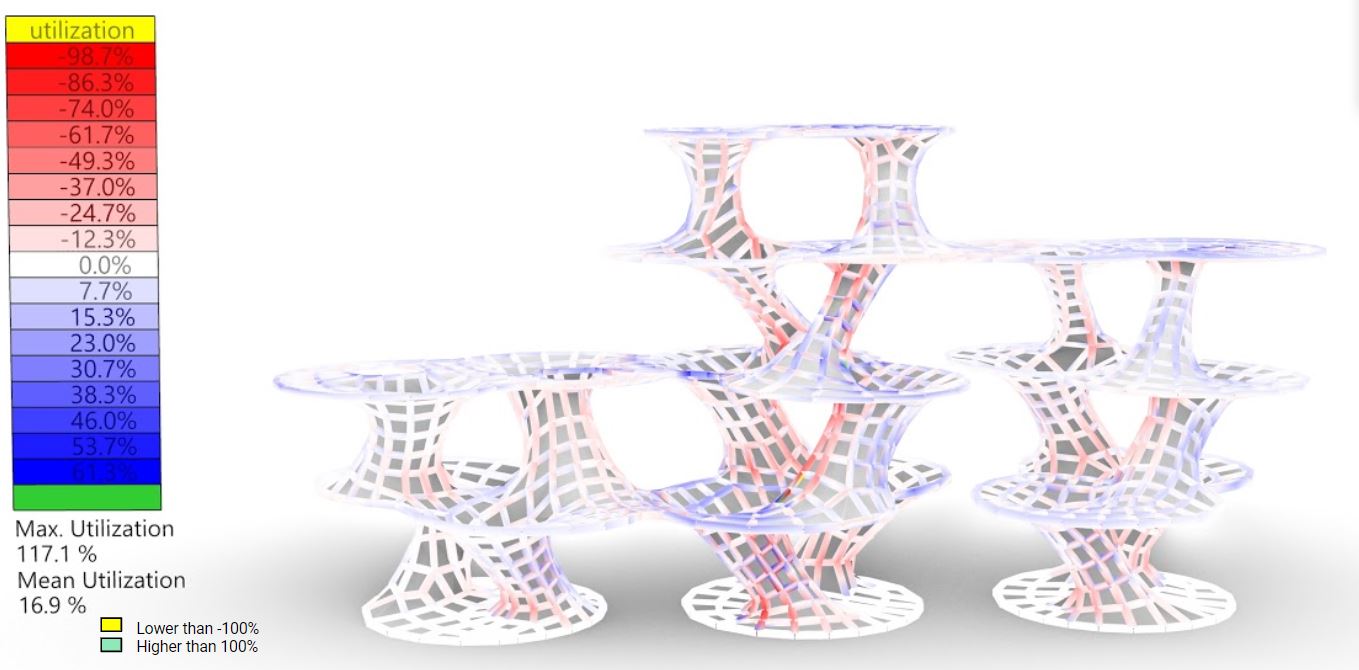
Member utilization-gravity and wind loads
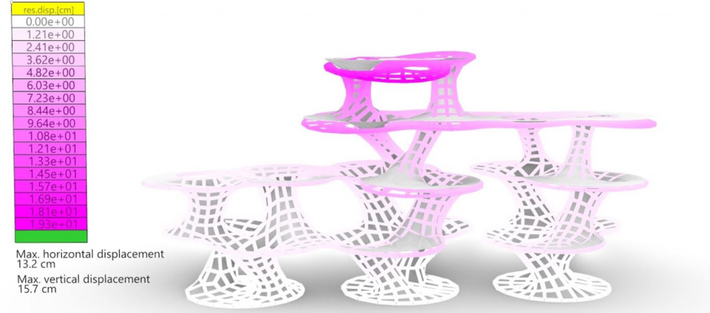
Member displacement-gravity and wind loads
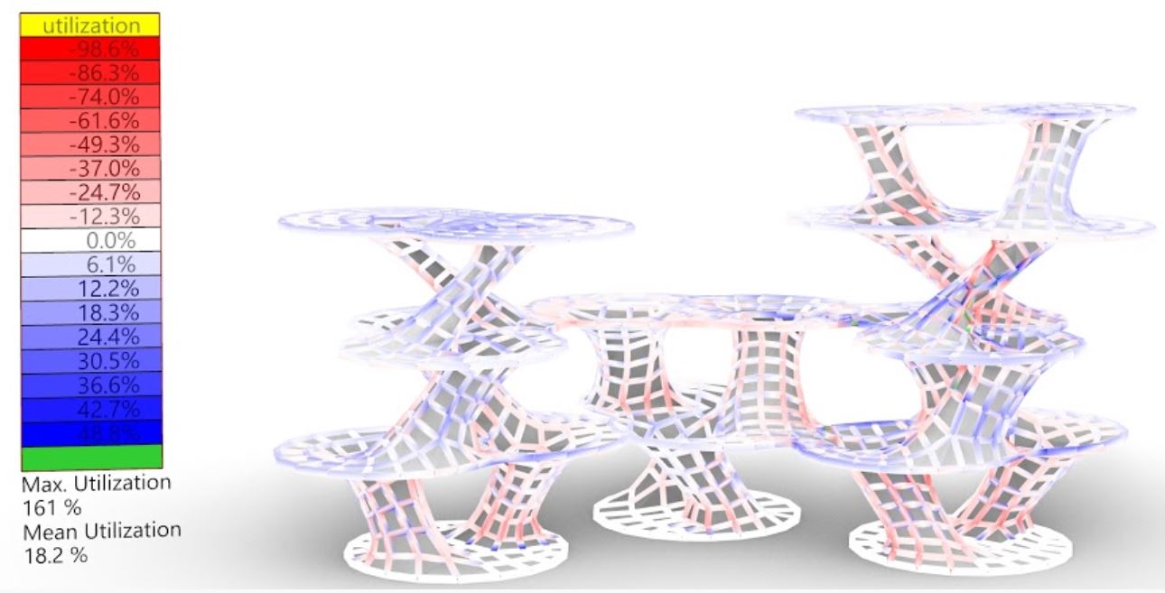
Member utilization-gravity and wind loads
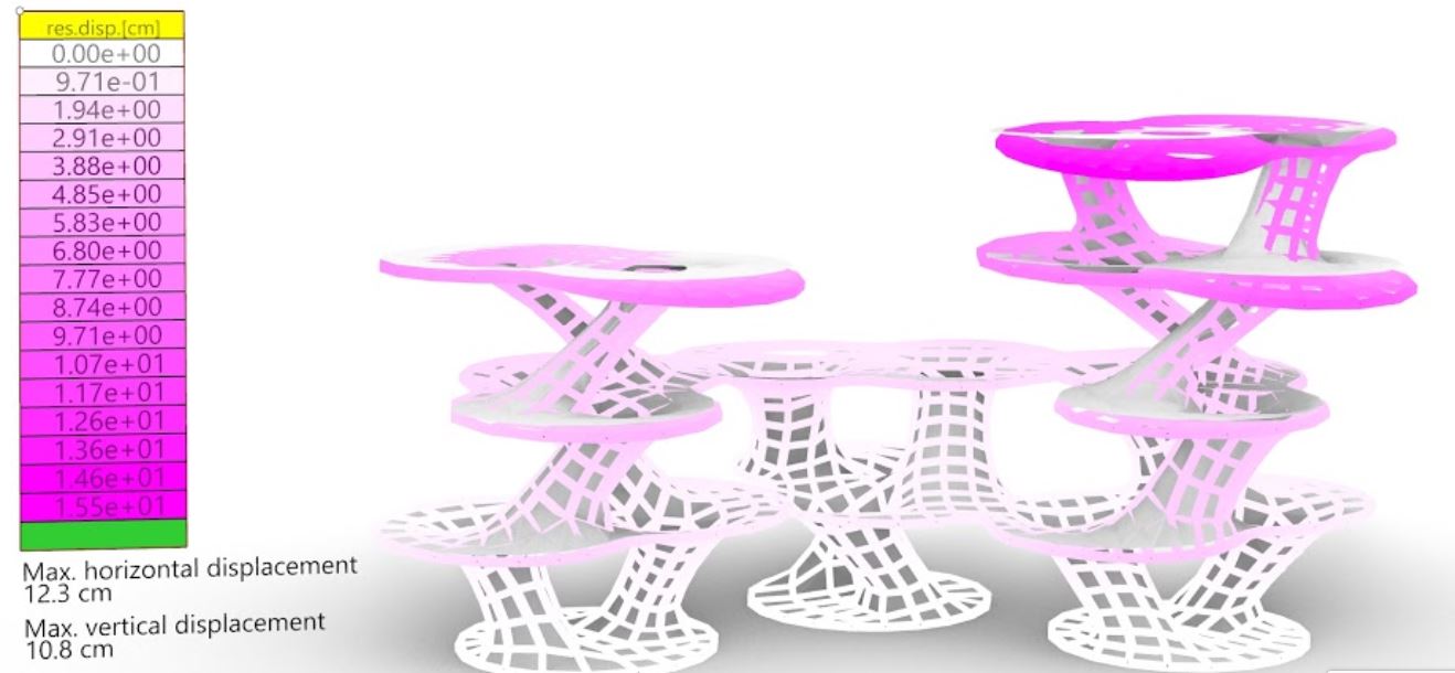
Member displacement-gravity and wind loads
05-ENVIRONMENTAL ANALYSIS
The rotation of the platforms at each level has been tested against environmental analysis including solar radiation simulation. In order to minimize self-shading and maximize sun exposure to the lower levels of the structure, an optimal range of rotation angles was established. The outcome minimum and maximum rotation angle was an input for a further view analysis study.
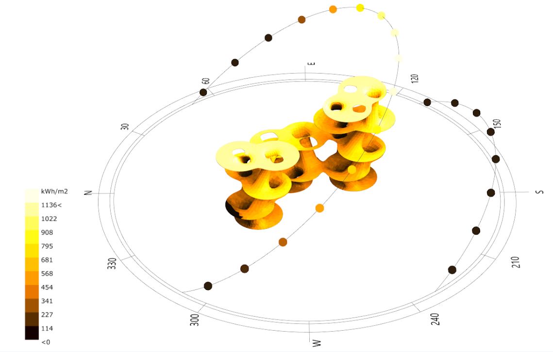
Annual solar radiation analysis
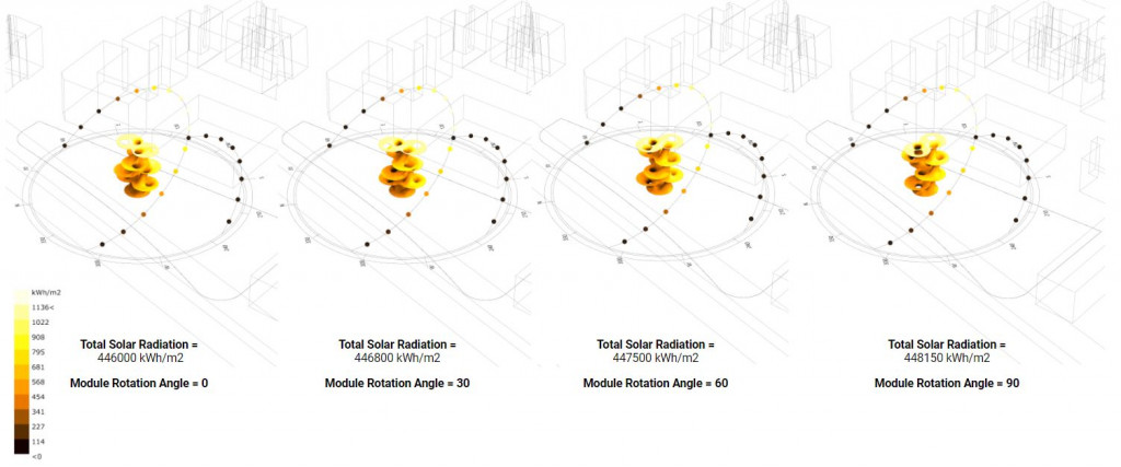
Annual solar radiation analysis
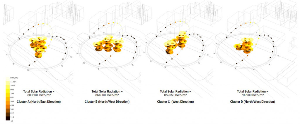
Annual solar radiation analysis
06-VIEW OPTIMIZATION
The final geometry optimization is concerned with the experience of the people visiting the highest level of the structure. The optimal rotation of the top-level floors is going to be defined, allowing the longest edge of the platform to be facing the previously identified landmarks in the neighborhood of the site. The outcomes of this step were considered together with the previous structural and environmental analysis to establish the final geometry.
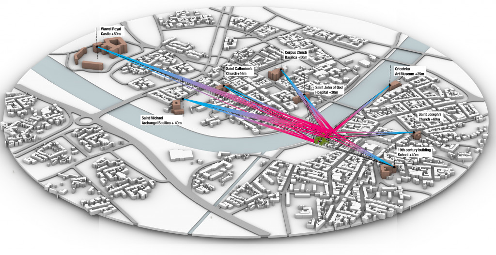
Surrounding historical buildings data
VARIABLES
1-Platform levels (5 to 25 meters)
2-Platforms orientation (-90 to 90 degree)
3-View angles and priority (no. view lines per platform)
4-Levels limitation
GOAL-01
Minimize the angle between the platform and the viewpoint.
GOAL-02
Minimize blocked view lines.
GOAL-03
Maximize view lines through the context.
View optimization process
Platform heights and orientation iterations based on the view optimization process
Wallace optimization graphs deviation
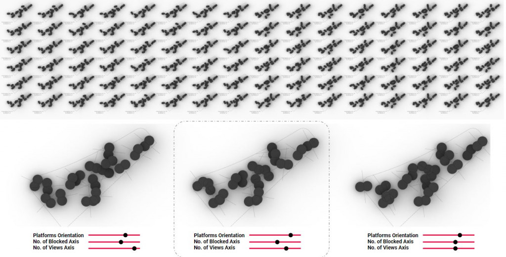
View optimization results

Optimized platform result vs final geometry
07-MODULE DETAILS
A developable strip technique is used to provide continuous structural layers to the structure. A C# script done by Laurent Delrieu was used in order to re-mesh the surface and unroll the geometry into multiple strips.
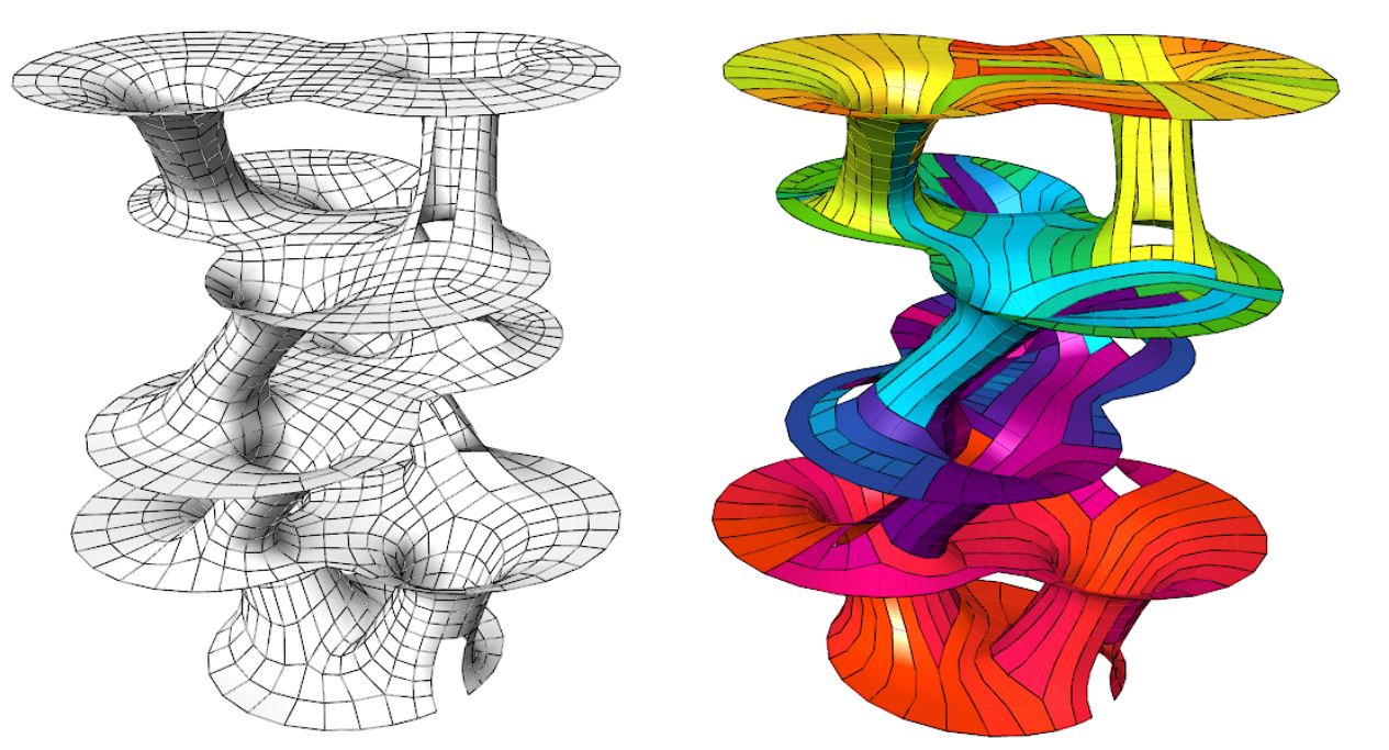
Quad re-meshing and developable strips diagram
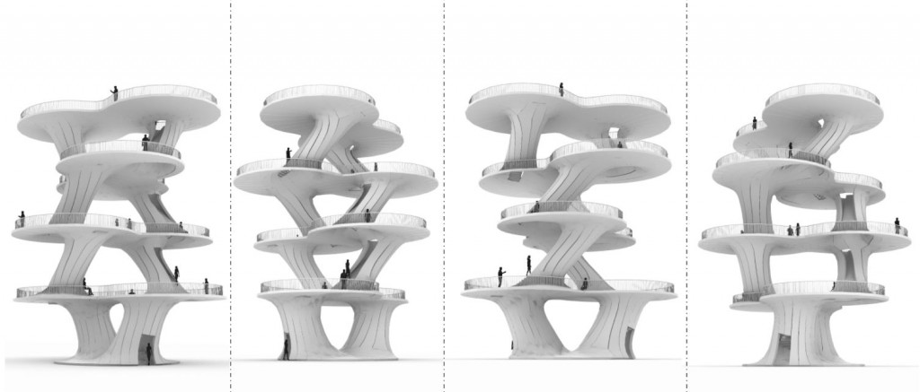
Module geometry from different view angles
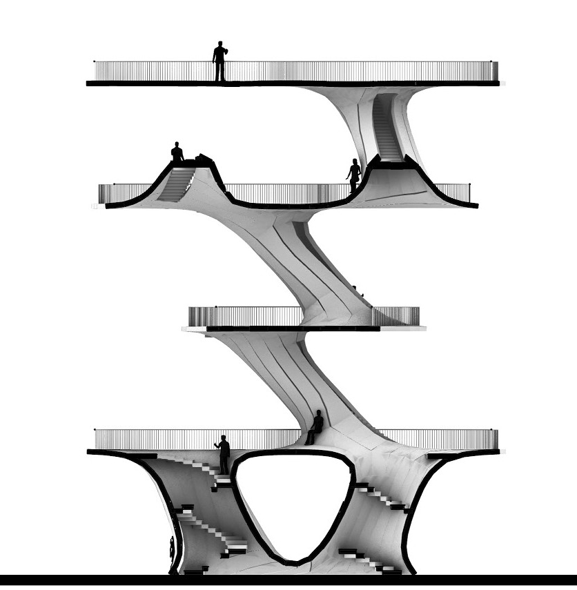
Sectional view
An animated vertical sectional view
An animated horizontal sectional view
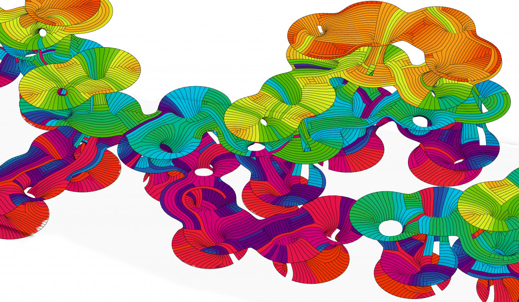
The developable strips technique applied to the whole model, using a C# script done by Laurent Delrieu was used in order to re-mesh the surface and unroll the geometry into multiple strips.
ARCHITECTURE QUALITY
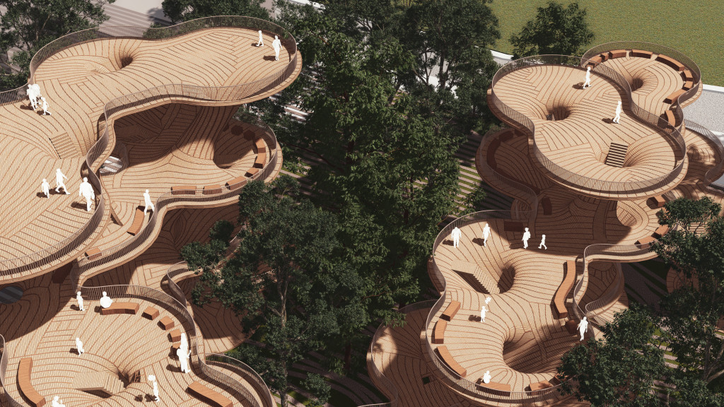

Floor Plan Drawing
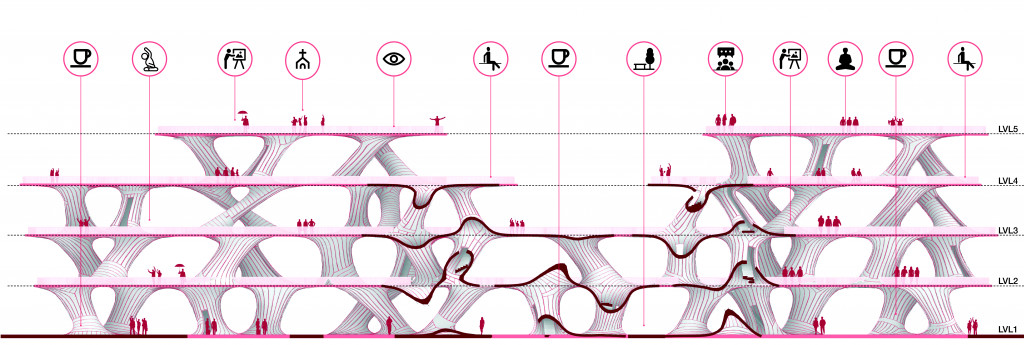
Section Drawing
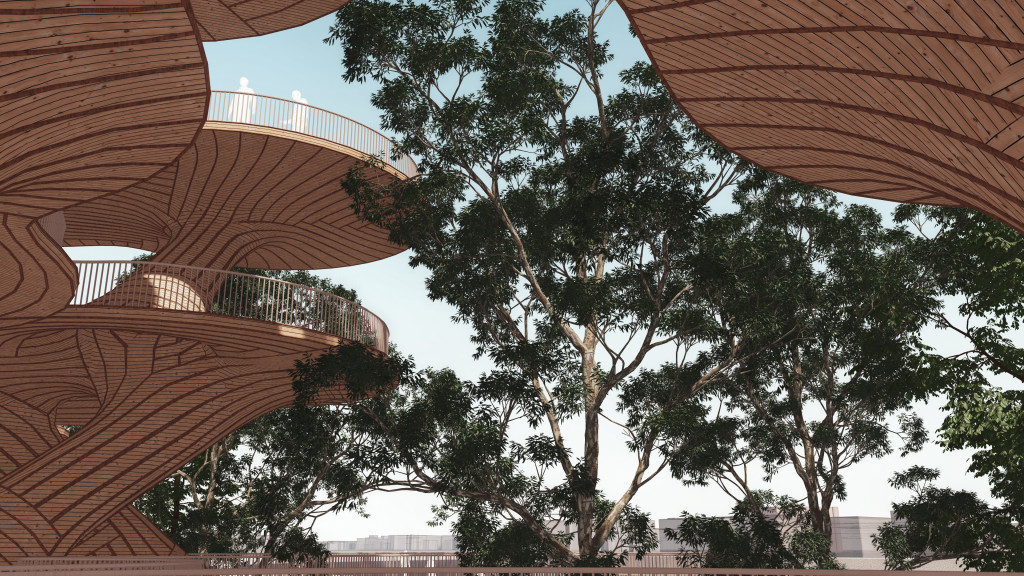
Widok is a project of IAAC, Institute for Advanced Architecture of Catalonia developed in the Master In Advanced Computation For Architecture & Design 2020/21 by
Students: Felipe Romero, Aleksandra Jastrz?bska, Hesham Shawqy
Lead Faculty: Rodrigo Aguire, Faculty Assistant: Oana Taut
